

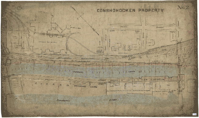
Did you know that Washington Street was once a canal? The Schuylkill Navigation Company was created in 1815 for the purpose of making the Schuylkill River navigable and this included the eventual creation of the 108 mile navigation system between Philadelphia and Port Carbon in Schuylkill County. The system was completed in 1825 and included 18 dams, 23 canals totaling just under 58 miles, 120 locks, 17 stone aqueducts, a 450 mile tunnel, 50 miles of slack water pools and 31 houses for toll and lock keepers.
The Reading Area Community Council created a website to provide history of the system after the discovery of maps and other documents. Here is a little history from the website:
The system was most prosperous between 1835 and 1841 although its record tonnage, nearly two million tons, occurred in 1859. During the second half of the 19th century the rise of the railroad, floods, droughts, and a miners’ strike contributed to the downfall of the system. In January 1870 the navigation system, was leased to the Philadelphia and Reading Railroad Company for 999 years although the railroad company was obligated to maintain the system in good condition except for the section north of Port Clinton which was abandoned around 1887. In 1896 the railroad property was sold to Coster and Stetson, but they elected not to assume the lease of the navigation system. From 1896 to 1902 the Philadelphia and Reading Railway Company operated the navigation system, but in April 1902 the Schuylkill Navigation Company resumed operations of the navigation system. In the 20th century commercial use of the navigation system decreased and ended in 1931. In 1949 the Schuylkill Navigation Company was acquired by the Commonwealth of Pennsylvania. In the late 1940s and early 1950s a joint federal and state effort, the Schuylkill River Desilting Project, dredged the river of the coal culms or particles, and constructed desilting basins. The collection at Reading Area Community College includes maps and drawings from the desilting project.
There are several more maps and documents available by clicking here.