
History is ever-present in the communities of the Freedom Valley. Plymouth Meeting is no exception. While the crossroads of Germantown and Butler Pikes is one of the few intersections left in the region with historical buildings on each of its corners, the neighborhood behind one of those corners is a suburban-style development. Split-level homes are standard here in Plymouth Meeting Park.
The roadways of this neighborhood highlight aspects of our country, but most of the landscapes memorialized here are found in the southern and western parts of the United States.
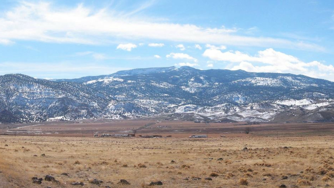
Boulder Road is one of these roadways. It is named after Boulder Mountain, seen in the photograph above (at top of article). This mountain is found in the southern part of Utah.
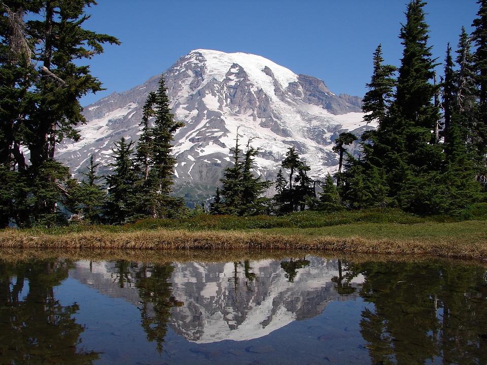
Rainer Road is named after Mount Rainer, seen in the photo above. This mountain – an active volcano – is the centerpiece of a national park of the same name in Washington State. To put the size of this national park into perspective, image a site 369 times the size of Conshohocken.
If you’d like to see live views of Mount Rainer, click on this link to the National Park Service.
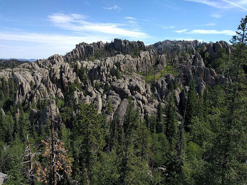
Black Hill Road is likely named after the Black Hills in South Dakota. Perhaps the “s” was dropped off of “Hills” from the beginning (we’re awaiting original maps from the surveyors) or perhaps the “s” was never included in the name. The photo above highlights the granite formations throughout this site. This region is of great importance to the Lakota.
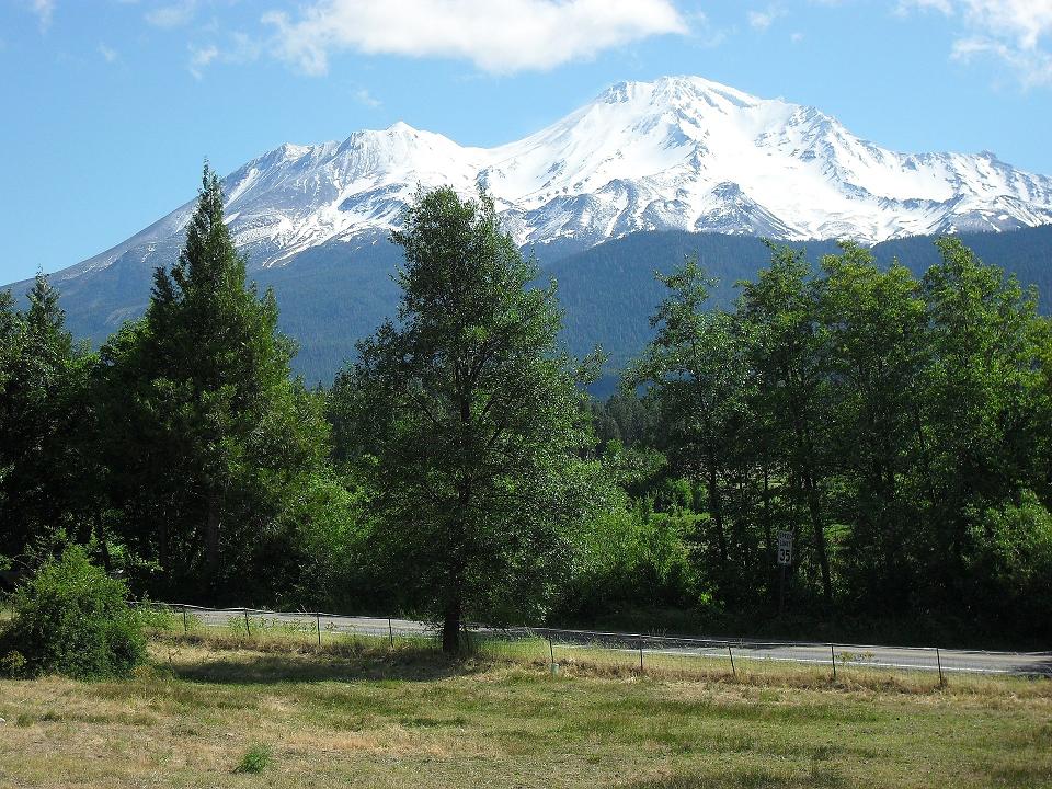
Shasta Road is named after Mount Shasta in California. The photo above showcases the mountain in all its glory. If you’ve ever had a flavored soda from Shasta Beverages, you’re sipping soda from a company that began as The Shasta Mineral Springs Company in 1889.
The source of the name of one of roadways in this neighborhood is uncertain. Queens Road is likely named after Queens Canyon, but which Queens Canyon is not clear. There is a Queens Canyon in the Inyo National Forest in Nevada, a Queens Canyon Trail in Bryce Canyon National Park in Utah, or a Queens Canyon Trail in Colorado.
Tomorrow, we’ll show maps showing the development of Plymouth Meeting Park from farmland to a neighborhood.
Do you have questions about local history? A street name? A building?
Your questions may be used in a future news article.
Contact Richard McDonough at freedomvalleychronicles@gmail.com.
Photo of Boulder Mountain is courtesy of Bob Palin through Wikimedia, 2004 and Photo of the Black Hills is courtesy of Runner1928 through Wikimedia, 2016
© 2017 Richard McDonough