

Google is publishing mobility data in relation to the Coronavirus mitigation effort. According to Google, “The reports chart movement trends over time by geography, across different categories of places such as retail and recreation, groceries and pharmacies, parks, transit stations, workplaces, and residential.” The data is through March 29th.
To put the data in some perspective, in regards to Montgomery County, the county made its emergency declaration on March 8th and started updating the public on positive test results that day. Governor Wolf closed schools in Montgomery County on March 12th.
Another thing to note is that February 17th was Presidents’ Day, so many businesses were closed.
You can view all of the data here. For charts for Pennsylvania and all of its counties here. Below are the ones specific to Montgomery County.
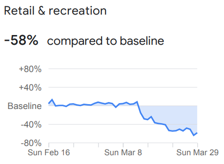
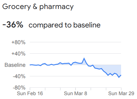
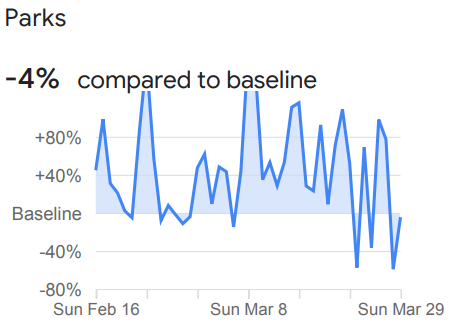
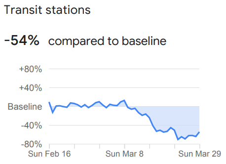
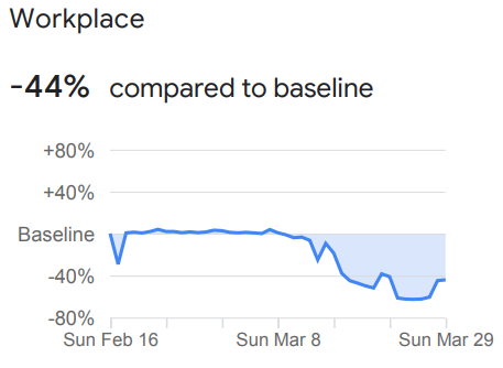
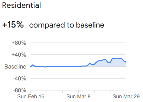
Charts: Google