
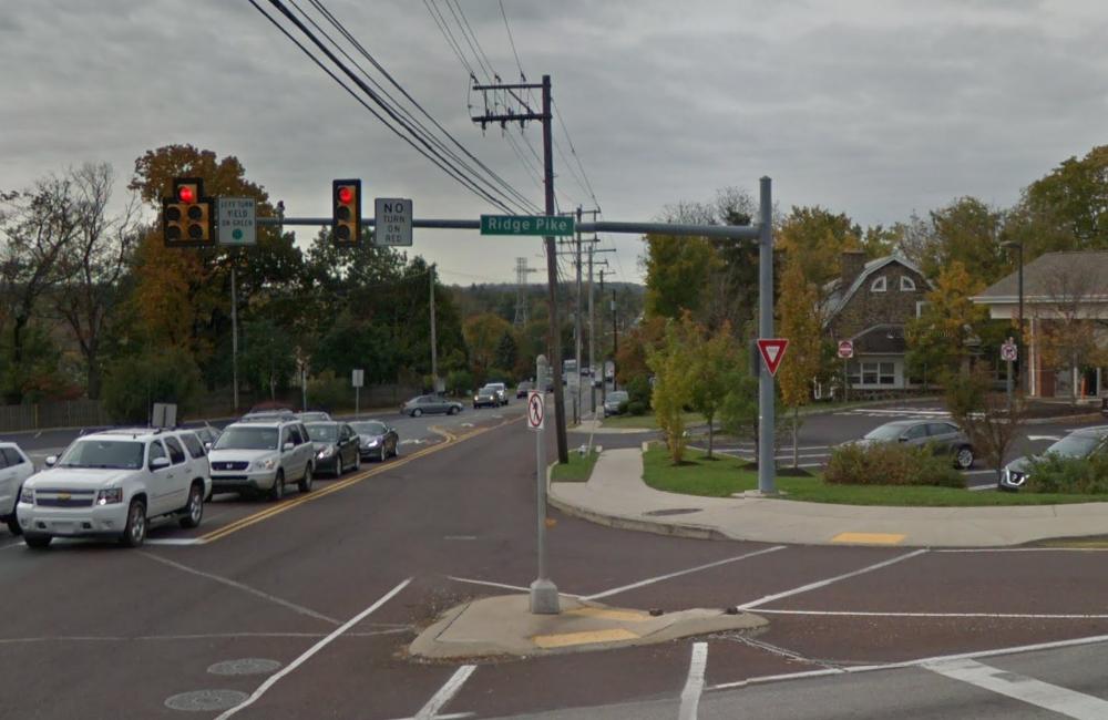
Ridge Pike is a major roadway from Philadelphia through the Freedom Valley west to Berks County. The modern roadway follows a trail through woods and fields made by members of Leni-Lenape nation in the years before European settlements.
The initial name of the road – Ridge Road – comes from the fact that the roadway follows a ridgeline in sections of the City of Philadelphia and beyond. The “pike” portion of the name comes from the fact that Ridge Pike was formerly a Turnpike. Just like the modern-day Pennsylvania Turnpike, people paid tolls to travel along the Ridge Turnpike.
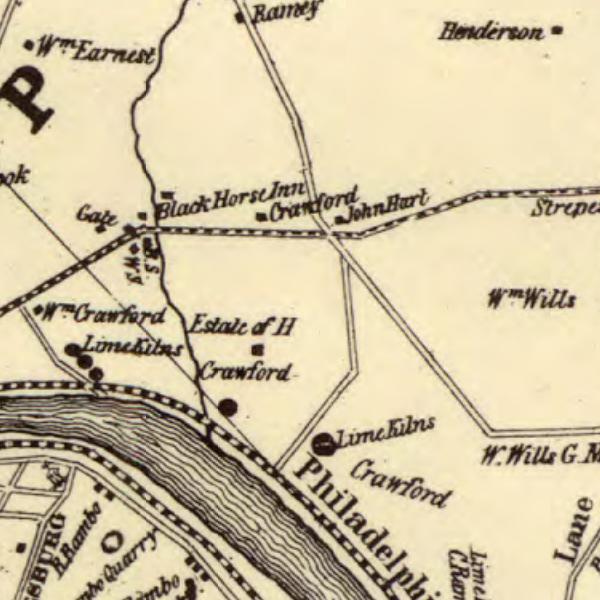
One of the toll gates that existed on the Ridge Turnpike can be seen in this map from 1848. Note the word “Gate” near the left side of this map. The dotted line is the Ridge Turnpike – today’s Ridge Pike. This toll gate was located where the Diamond Run crosses the roadway in Plymouth Township.
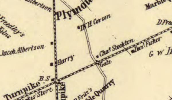
Another toll gate was located on the Ridge Turnpike – the roadway is noted as a dotted line from the lower left-side of this map to near the top of the right-side of this map. The toll gate – “Gate” near the center of this map – was located at the intersection of today’s Spring Mill Road with today’s Ridge Pike in Whitemarsh Township.
In years past, Ridge Pike was known by a variety of names in addition to the “Ridge Turnpike”. Many people called the road the “Reading Road” because it went to the City of Reading in Berks County.
Before the Plymouth Meeting postal address was expanded into the Mogeetown and Black Horse sections of Plymouth Township, a section of Ridge Pike was also known as “Main Street” in those neighborhoods. That street name came from the fact that Ridge Pike was the main commercial street in Norristown. The Norristown postal address had been used for generations to designate sections of Plymouth Township, including in the Mogeetown and Black Horse neighborhoods.
As a side note, “Main Street” in Norristown was also known as “Egypt Street”. A building in Downtown Norristown still has “Egypt Street” etched into its structure. The name “Egypt” was attached to this roadway because Main Street and Egypt Road went to “The Fatlands” – the section of Montgomery County where the Schuylkill River and the Perkiomen Creek come together. Water from the River and the Creek provided the critical ingredient that created fertile fields that early European settlers found reminiscent of the Nile River in Egypt.
During a number of decades during the 20th century, Ridge Pike was also known as “Alternate U. S. Route 422”. This was during the years before the name “U. S. Route 422” was attached to a limited-access, divided highway from King of Prussia to Pottstown.
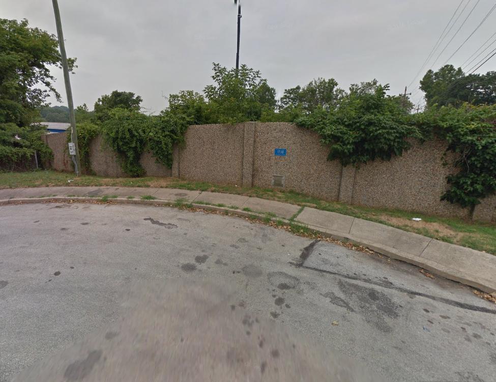
“Craven Street” is not just a former name for a street, it’s a name for a former street. Craven Street used to exist in the Connaughtown section of Plymouth Township. When you travel on the Mid-County Expressway (the “Blue Route”) between West Conshohocken and Plymouth Meeting, you likely have no idea that you are traveling over the roadbed where Craven Street used to exist. This street was demolished as part of the construction of the expressway.
While no longer in existence, there are indications that the roadway was once part of the landscape. For example, Section 13-41 of the Plymouth Township Code – Commercial vehicle: prohibited from certain streets except for local deliveries and pickups, the Township still includes mention of Craven Street:
“Old Elm Street, (Conshohocken Road) between Craven Street and Light Street.”
Section 13-21 of the Plymouth Township Code – Parking prohibited at all times on certain streets for loading and unloading, the Township still prohibits parking on sections of Craven Street:
“Craven Street, on the westerly side, from its intersection with Conshohocken Road to its intersection with Fulton Street.”
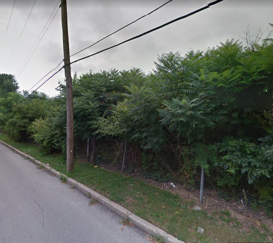
Craven Street used to be found behind this fence – where today’s Blue Route is located.
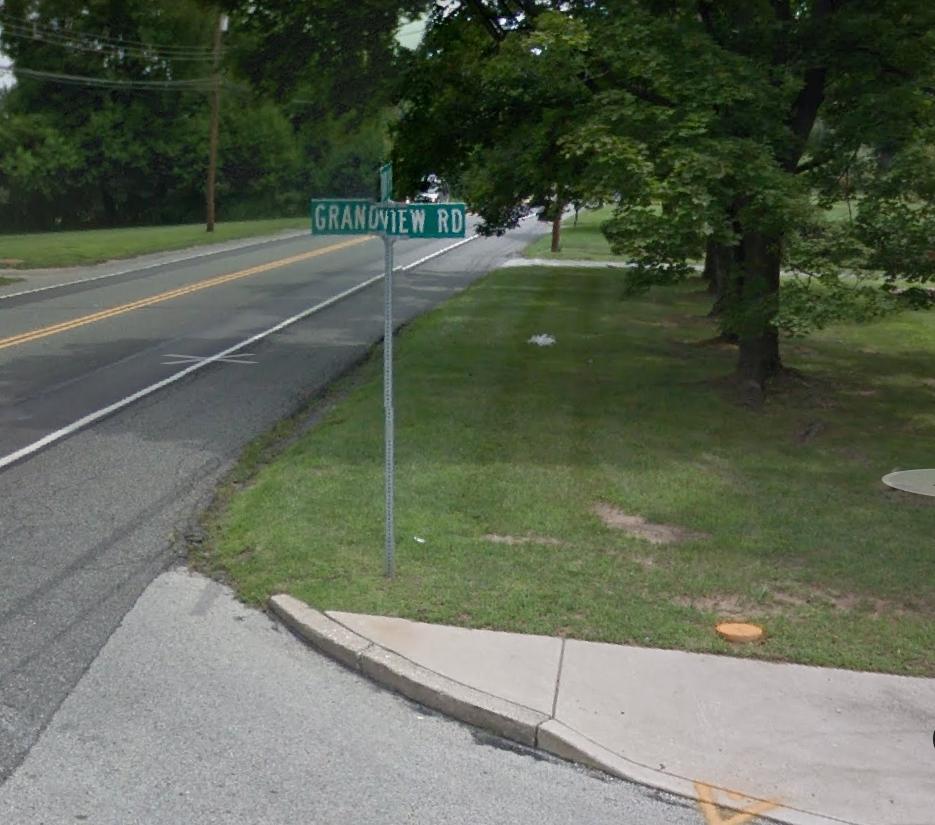
Grandview Road is only one block long, traveling from Sandy Hill Road to a joint intersection with both Louella Drive and Plymwood Drive in Plymouth Township. No one has actually ever had an address on Grandview Road, but nonetheless, the original name was changed to avoid confusion in the area.
That original name – “Terrace Road” – was given based on a road of the same name on the other side of Sandy Hill Road and based on Terrace Road being the main entrance to a housing development being built – “Terrace Wood West”. When this neighborhood was built, the view was that the roadways should share a common name. This, even though the two Terrace roads never actually intersected together – a jughandle had been created.
While Plymouth Township took ownership of the road on January 11, 1965, “Terrace Road” was the official name for this street as a public roadway for less than a year. On December 13, 1965, the Plymouth Township Board of Commissioners (the predecessor governing board to today’s Plymouth Township Council) passed an ordinance to change the name of this one block street from “Terrace Road” to “Grandview Road”.
The name “Grandview Road” came from the “grand views” that can be seen from the intersection of Sandy Hill Road and Grandview Road.
In Part Three, we’ll detail additional streets that have names today that are different from their names in the past.
The image of Ridge Pike is courtesy of Google, 2017.
The maps are a portion of a map from 1848 courtesy of the Commonwealth of Pennsylvania Historical and Museum Commission.
The images of Grandview Road and the former locations of Craven Street are courtesy of Google, 2012.
Do you have questions about local history? A street name? A building?
Your questions may be used in a future news article.
Contact Richard McDonough at freedomvalleychronicles@gmail.com.
© 2018 Richard McDonough