
While fans of the Philadelphia Eagles celebrate the team’s win over the New England Patriots, it might be a good thing to remember that there are several communities in the Freedom Valley that take their neighborhood names or the names of their streets directly from Boston and its nearby New England neighbors.
Horrors!
Some might recommend that you express sympathy to the unfortunate residents of the Freedom Valley who must bear the shame of living in neighborhoods or on streets related to Boston and New England.
In Plymouth Township, Valley Stream Farms is one of those neighborhoods. It is located at the intersection of Township Line Road and Jolly Road.
Township Line Road gets its name because it sits on the boundary line between Plymouth Township and Whitpain Township, between East Norriton Township and Whitpain Township, and between East Norriton Township and Worcester Township.
The Jolly Family gave its name to Jolly Road. The specific family member (or, perhaps, family members) for whom this roadway was named is not certain, but Mr. Charles Jolly was a resident of Whitpain Township as of March 19, 1763, according to Bean’s History of Montgomery County.
In 1959, development began of the farmland where these two roadways come together in Plymouth Township. A small patch of woodlands was also developed into the neighborhood of Valley Stream Farms. Streets names within the housing development were inspired by historical aspects of Boston and its New England neighbors.
![]()
Beacon Hill Lane gets its name from the Beacon Hill neighborhood in Boston that is home to the Massachusetts State House. According to the City of Boston, this neighborhood got its name from a beacon that was previously located on top of the hill (the hill no longer exists); the beacon was used to warn residents of invasions. Boston officials indicate that poet Robert Frost, political leader Daniel Webster, member of the United States Supreme Court Oliver Wendell Holmes Jr., and novelist Louisa May Alcott all were once residents of Beacon Hill.
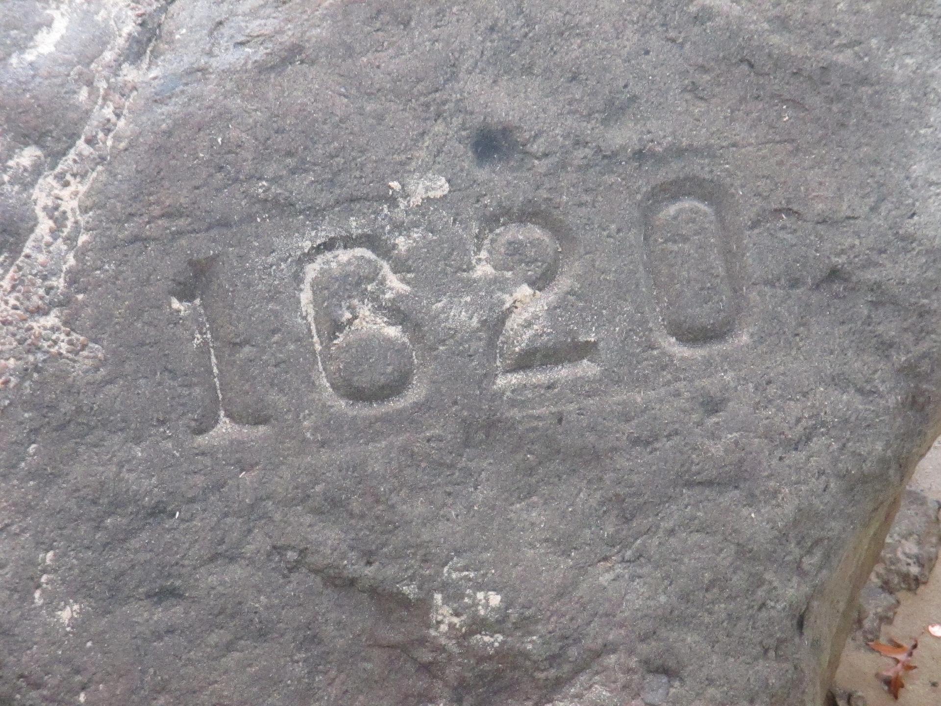
Plymouth Rock Road gets its name from Plymouth Rock – the site where tradition notes that the Mayflower ship landed in America in 1620. This was the start of the Plymouth Colony by Pilgrims arriving from England. The Commonwealth of Massachusetts maintains this landmark as part of Pilgrim Memorial State Park.

Revere Circle is named after Paul Revere, the American Patriot that helped warn residents of the Boston area that the British troops were coming. He is warmly remembered by Americans throughout the nation. You can read more about Paul Revere by clicking here.
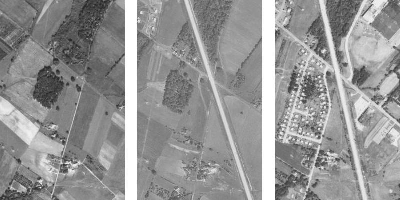
These aerial images show the development of farmland (as well as a small patch of woodlands) into the neighborhood of Valley Stream Farms. The photo on the left shows the area as of October 8, 1942. Township Line Road goes from the upper left-side of the photo to the center of the right-side of the photograph. Jolly Road goes from the lower center of the photograph to the upper right-side of the photo. Note that Jolly Road is a straight roadway at this time and has only one intersection with Township Line Road.
The middle photograph – taken on September 23, 1958 – shows that the Northeast Extension of the Pennsylvania Turnpike has been built through farmland and woodlands. The intersection of Jolly and Township Line Roads has been transformed into two intersections because of the construction of the Turnpike. One of the intersections with Township Line Road today is with Jolly Road, while the second intersection is with Union Meeting Road; Jolly Road still exists in Whitpain Township, but it no longer officially has an intersection with Township Line Road in that municipality.
The photo to the right, from August 6, 1971, shows that the housing development of Valley Stream Farms has now been constructed. Single-family homes have now been built on Beacon Hill Lane, Plymouth Rock Road, and Revere Circle. Commercial development can be seen along sections of Township Line Road in both Plymouth and Whitpain Townships.
The three aerial photos are courtesy of the United States Department of Agriculture and the Pennsylvania Geological Survey, 1942, 1958, and 1971.
Do you have questions about local history? A street name? A building?
Your questions may be used in a future news article.
Contact Richard McDonough at freedomvalleychronicles@gmail.com.
© 2018 Richard McDonough