
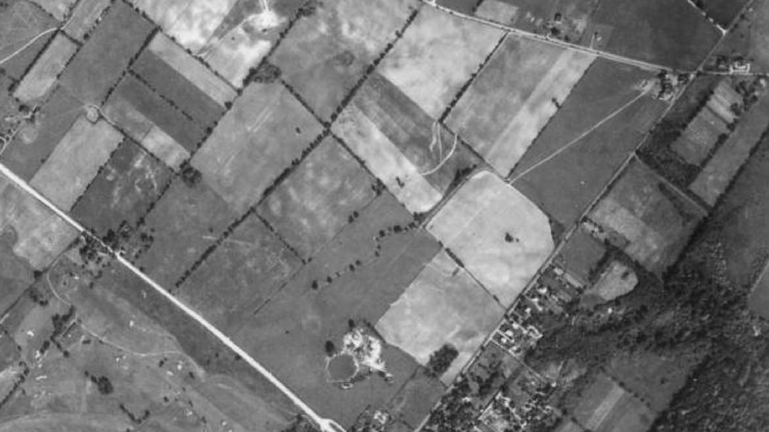
This aerial image shows what central Whitemarsh Township looked like in 1942. The white line that goes from the center of the left-side of the photo to the center of the bottom of the image is Germantown Pike. Joshua Road is the line that goes from the center of the bottom of the photo to near the top of the right-side of the image. Flourtown Road is the line goes from the top of the left-side of the photo to the right-side of the image.
At the time of this photo, there was little development in this section of the Freedom Valley. The WFIL Radio Towers had not yet been built. The Plymouth Whitemarsh High School, the Colonial Elementary School, and the Whitemarsh Elementary School were yet created. None of the residential housing developments from Joshua Road to Plymouth Meeting had yet been built. The Green Valley Country Club can be seen in the lower left section of this photo.
Note the round object near the intersection of Germantown Pike and Joshua Road. That was a quarry filled with water. This watering hole was utilized by local residents to cool off on hot summer days, among other times.
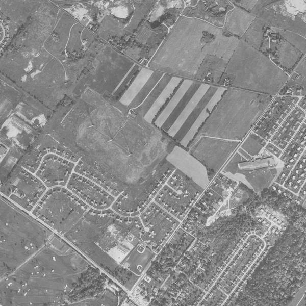
This photo, taken from the air in 1958, shows the WFIL Towers. The three radio towers can be seen near the center of this image. Housing developments have been built by this date in this section of Whitemarsh Township. The Whitemarsh Elementary School is the building seen near the center of the right-side of this image; the school is located on Joshua Road. The Colonial Elementary School – initially the Whitemarsh Junior High School – has not yet been built.
WFIL donated 11 acres of land to Whitemarsh Township for recreational purposes near Joshua Road and Germantown Pike. At least two baseball fields in Miles Park can be seen near the bottom center of this photo. As of 1958, land along much of Flourtown Road is still being farmed or is still rural in character.
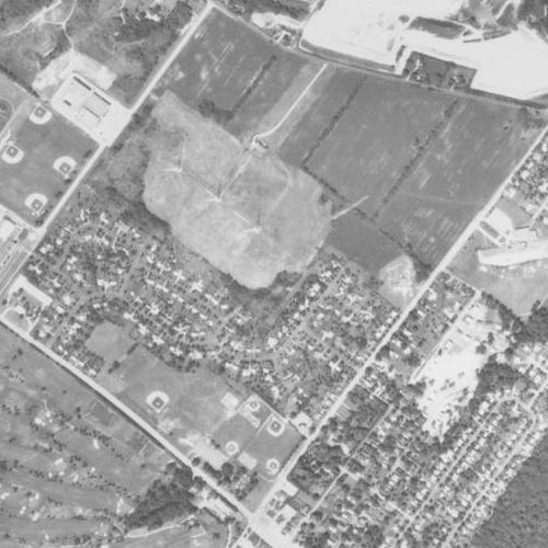
In 1971, at the time of this photo, the WFIL Towers were still in operation; you can see the transmission towers in the center of this aerial photo. Educational and recreational activities have been further expanded by the time of this photo. The Whitemarsh Junior High School – the same building now houses today’s Colonial Elementary School – is in operation; it is located in the upper left-side of this image.
Four baseball diamonds can be seen near the Whitemarsh Junior High School. They served both the junior high school as well as the Plymouth Whitemarsh High School. A number of athletic fields can be seen near the bottom center of this photo. These sports facilities formed the core of Miles Park.
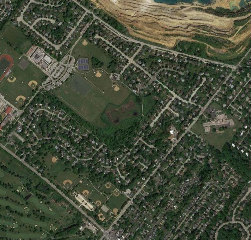
The 214 acres owned by WFIL in 1947 has now been completely subdivided and developed for residential, educational, religious, governmental, and recreational uses. The Colonial School District maintains its Victory Fields, seen near the center of this photo. Whitemarsh Township maintains Miles Park, near the center bottom of this image, as well as McCarthy Park, the wooded area seen in this photo that is adjacent to the Victory Fields. The Whitemarsh Community Ambulance Association and the William Jeanes Memorial Library are both located on Joshua Road.
The first three aerial photos are courtesy of the United States Department of Agriculture and the Pennsylvania Geological Survey, 1942, 1958, and 1971.
The fourth photo is courtesy of Google, 2017.
Do you have questions about local history? A street name? A building?
Your questions may be used in a future news article.
Contact Richard McDonough at freedomvalleychronicles@gmail.com.
© 2018 Richard McDonough