
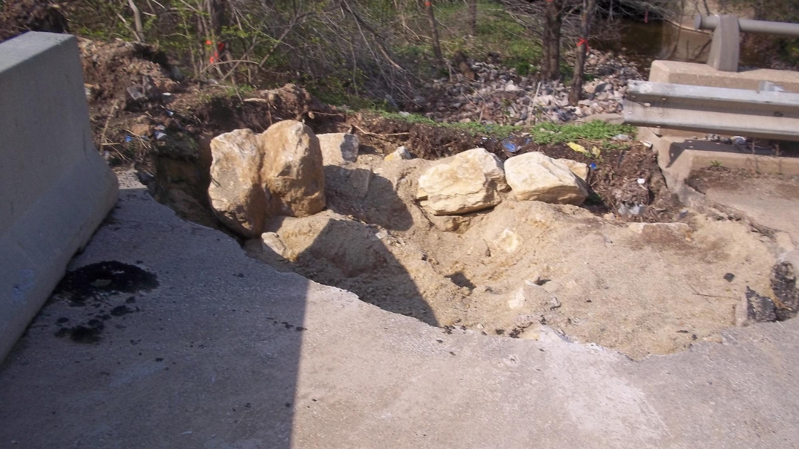
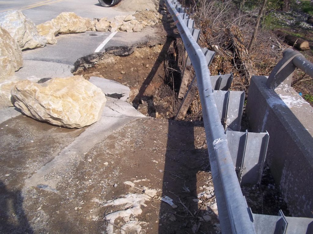
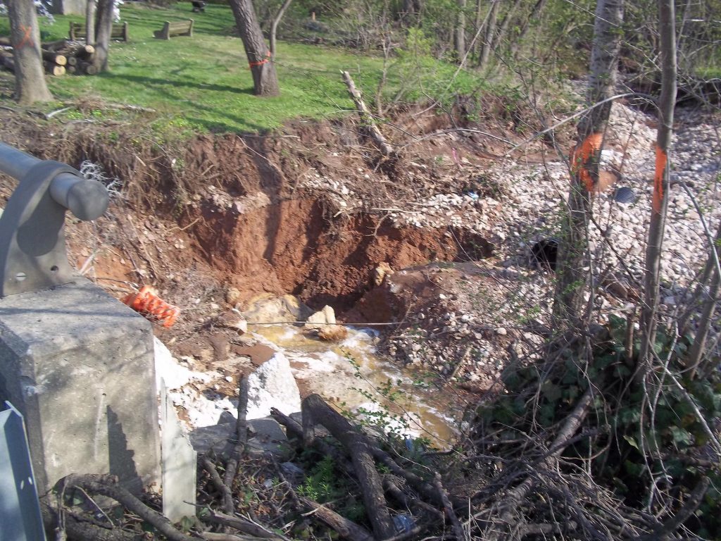
This is some of the damage caused on the Plymouth Road Bridge by one of the area sinkholes. The photograph was taken on April 21, 2015. A Jersey barrier is located to the left in this photo to prevent vehicles and pedestrians from being injured on the bridge.
Sinkholes have played havoc with roadways throughout the Freedom Valley.
Sometimes, it is a modest sinkhole on the edge of a road. But sometimes, sinkholes have taken out key sections of highways.
Such was the case with a road near the Plymouth Meeting Mall in the winter of 2014-2015.
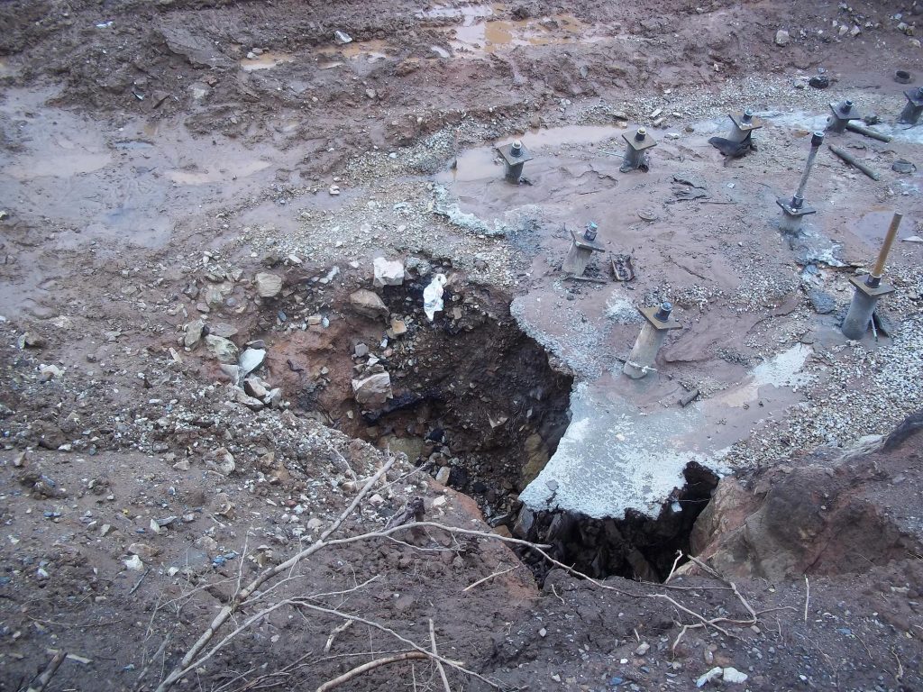
According to an abstract presented by representatives of the Pennsylvania Department of Transportation (PennDOT) and HDR, Inc. of Plymouth Meeting at the Highway Geology Symposium in Colorado Springs, Colorado in July of 2016, a sinkhole developed in December of 2014 next to “the downstream apron” of the Plymouth Road Bridge.
“On March 12, 2015, Plymouth Road was closed and detoured between Interstate 476 and Butler Pike,” stated Ms. Ayanna Williams, Community Relations Coordinator for Engineering District 6 of PennDOT. Ms. Williams explained that the closure was necessary “to replace the bridge carrying Plymouth Road over Plymouth Creek in Plymouth Township as a result of the sinkhole.”
Construction began quickly on this roadway due to its importance in the regional highway network. As work was done, additional sinkholes surfaced at this site.
The contractor hired by PennDOT “began construction on April 27, 2015, to remove the damaged Plymouth Road Bridge,” stated Ms. Williams. “The former bridge, built in 1962, was not repairable because of the extent of the structural and foundation damage.”
According to several reports, sinkholes were a common problem facing this bridge.
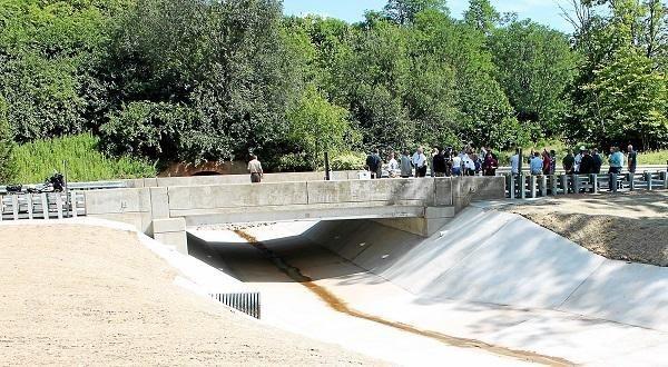
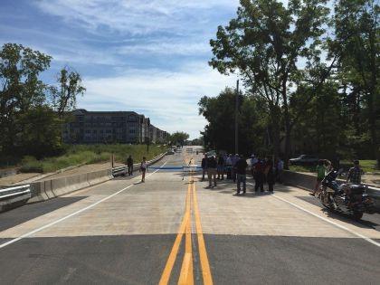
Ms. Williams explained the removal of the old bridge allowed the construction of “a new single-span, pre-stressed concrete box beam structure supported by reinforced concrete abutments on steel, micro-pile foundations. The new bridge is 31 feet long and 43 feet wide. It carries two, 12-foot-wide lanes and 8-foot-wide shoulders.”
“The new micro-pile foundation is designed to be strong enough to support the bridge should any additional ground movement occur,” stated Ms. Williams. “Forty-eight steel piles were driven and socketed into bedrock to support the two bridge abutments.”
The cost for this bridge construction project was $2,240,240.00, according to Ms. Williams, and was financed with state funds.
Three firms played roles in the construction of this new bridge.
According to PennDOT, Loftus Construction, Inc. of Cinnaminson, New Jersey, was the general contractor. The project was designed by HDR, Inc. of Plymouth Meeting. The underground investigation and foundation design work was done by American Geotechnical & Environmental Services, Inc. of King of Prussia.
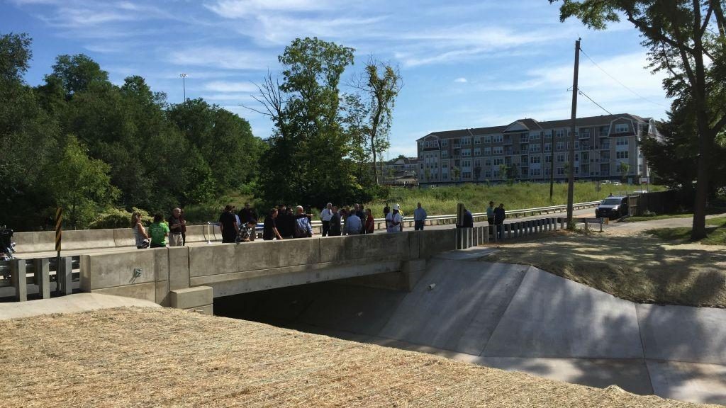
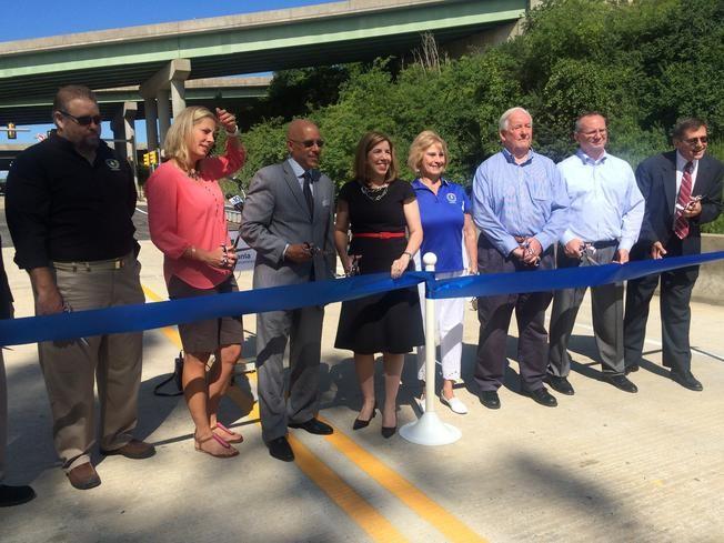
The new Plymouth Road Bridge opened on August 27, 2015.
Traffic on Plymouth Road close to the old Plymouth Road Bridge was estimated to have been an average annual daily traffic count of 10,236 vehicles northbound and an average annual daily traffic of 11,534 southbound in March of 2014, according to data from the Delaware Valley Regional Planning Commission.
The PennDOT Traffic Volume Map for Montgomery County showed that the traffic on Plymouth Road in this area was between an annual average daily traffic count of 13,000 vehicles each day and an annual average daily traffic count of 16,000 vehicles in 2016. (The PennDOT map does not indicate specific traffic counts on the bridge itself in 2016.)


The top photograph of the former Plymouth Road Bridge is courtesy of Loftus Construction, Inc., 2015.
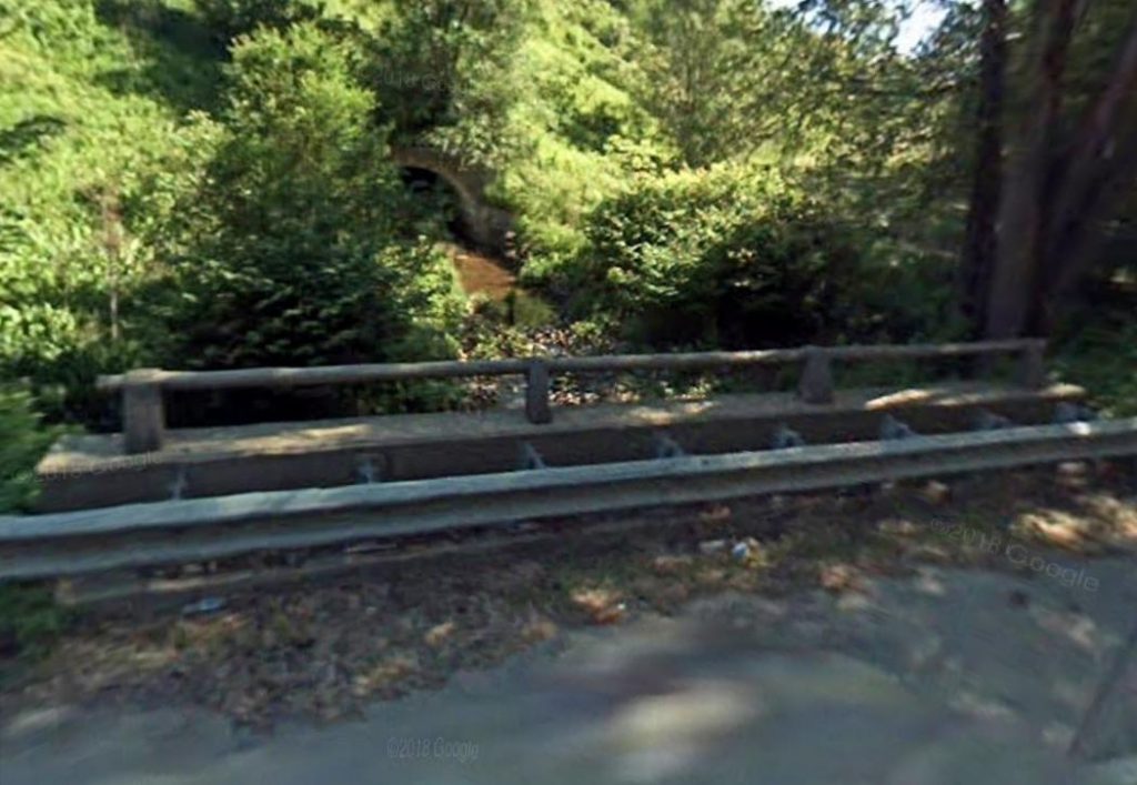
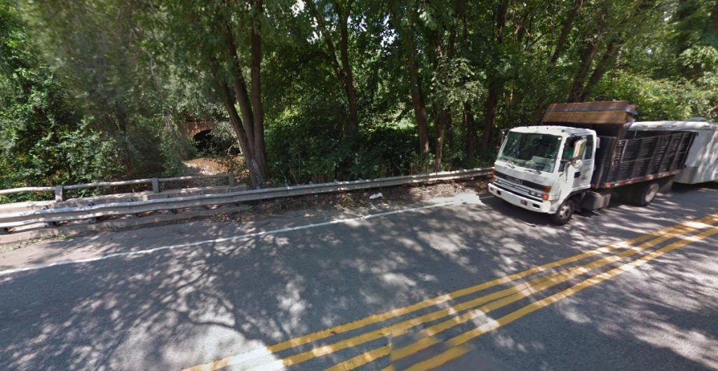
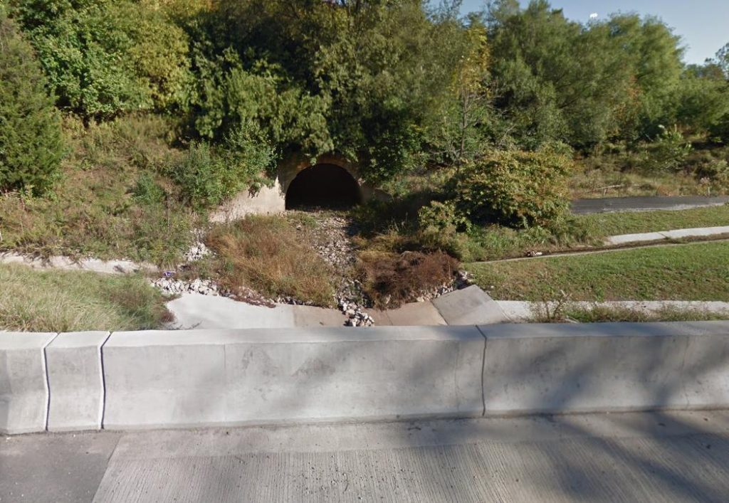
The photographs of the Plymouth Road Bridge in 2009, 2012, and 2017 are courtesy of Google, 2009, 2012, and 2017.
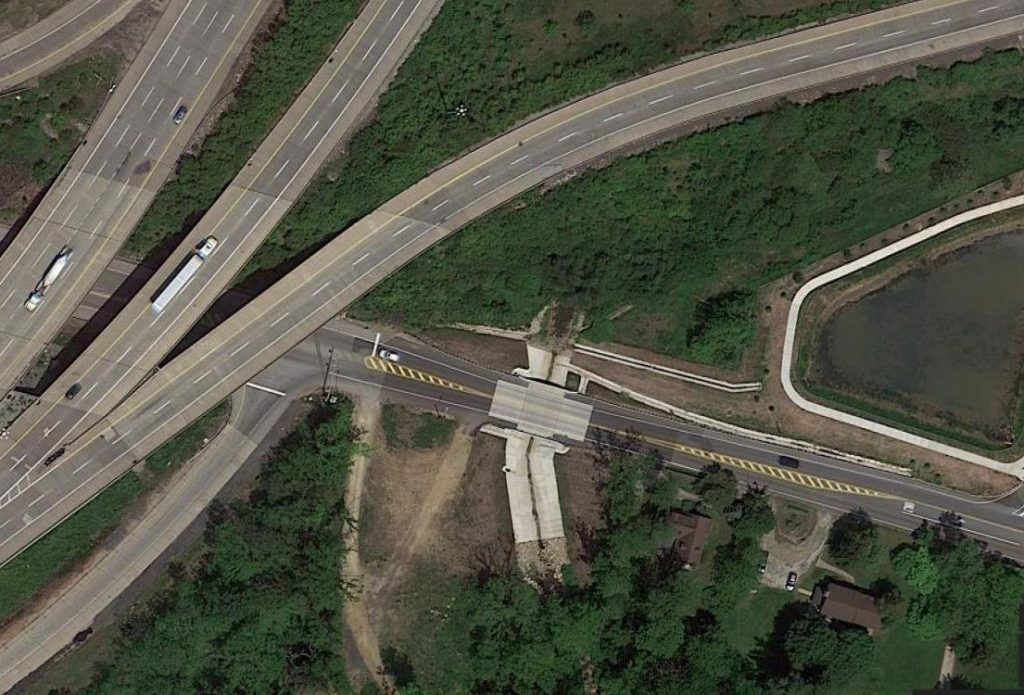
The aerial photograph of the Plymouth Road Bridge in 2017 is courtesy of Google, 2017.
The image of the design plans for the Plymouth Road Bridge is courtesy of Loftus Construction, Inc., 2015.
The photographs of the damaged former Plymouth Road Bridge are courtesy of Loftus Construction, Inc., 2015.
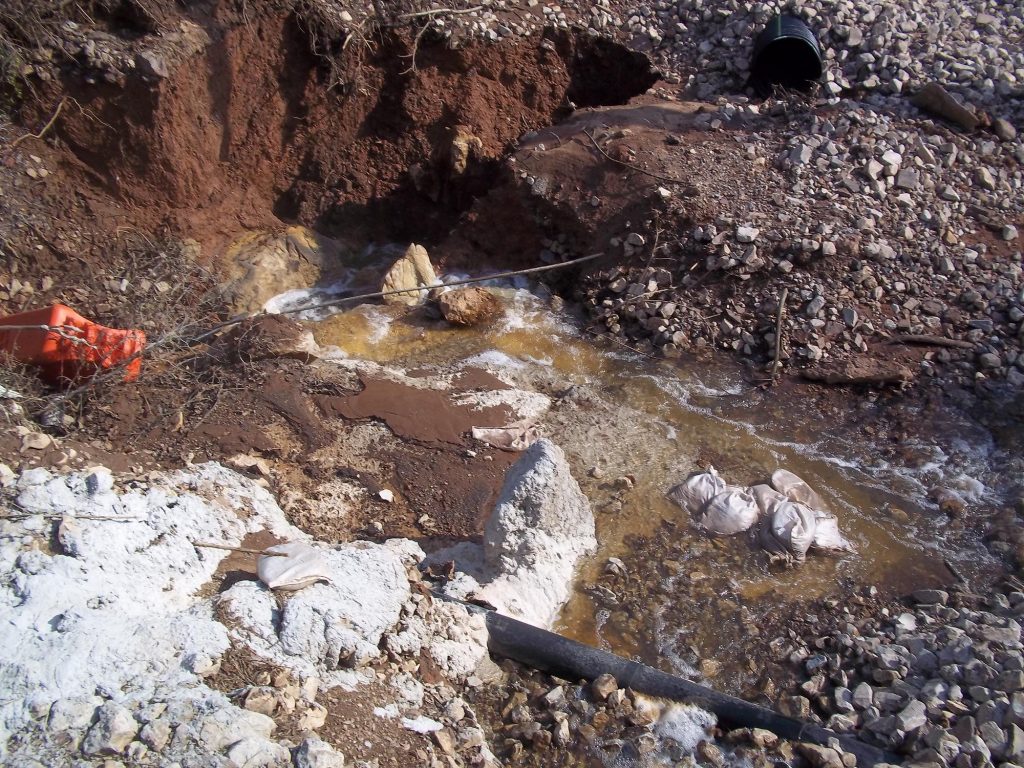
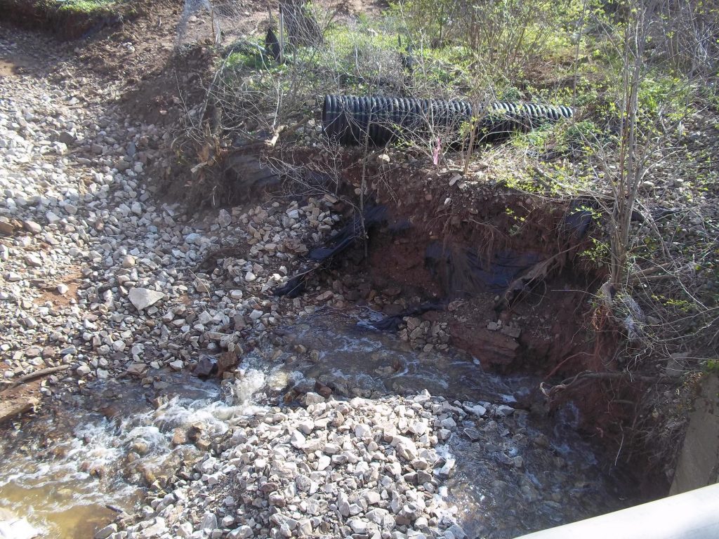
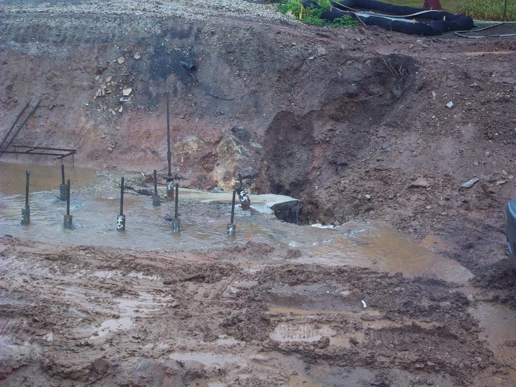
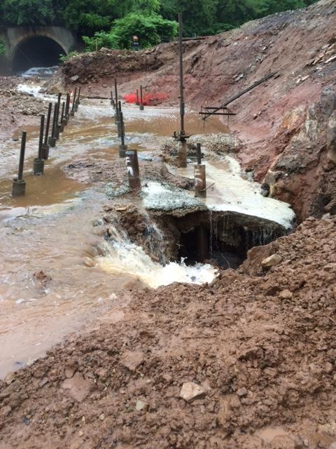
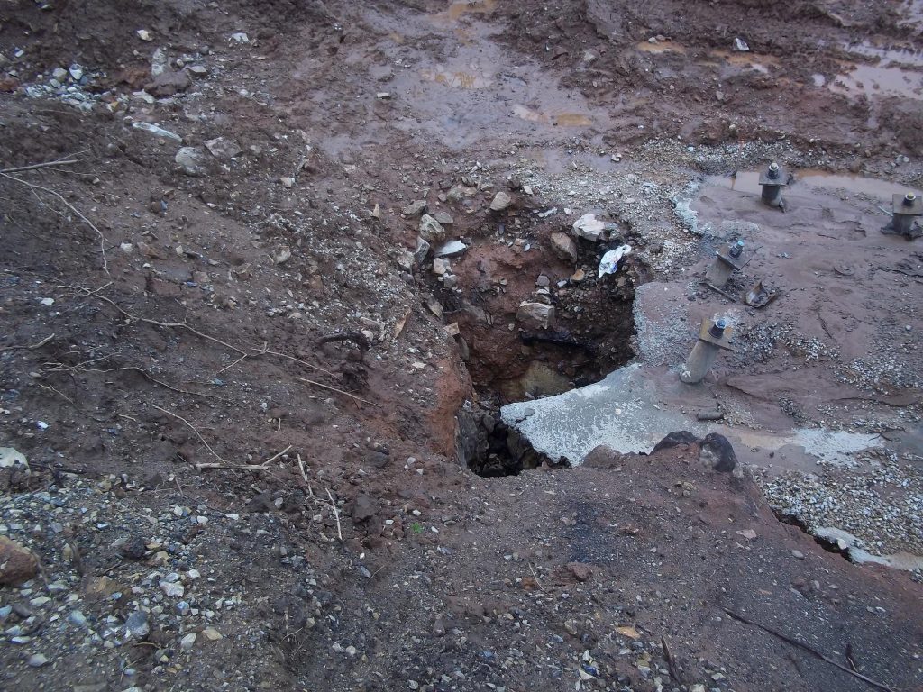
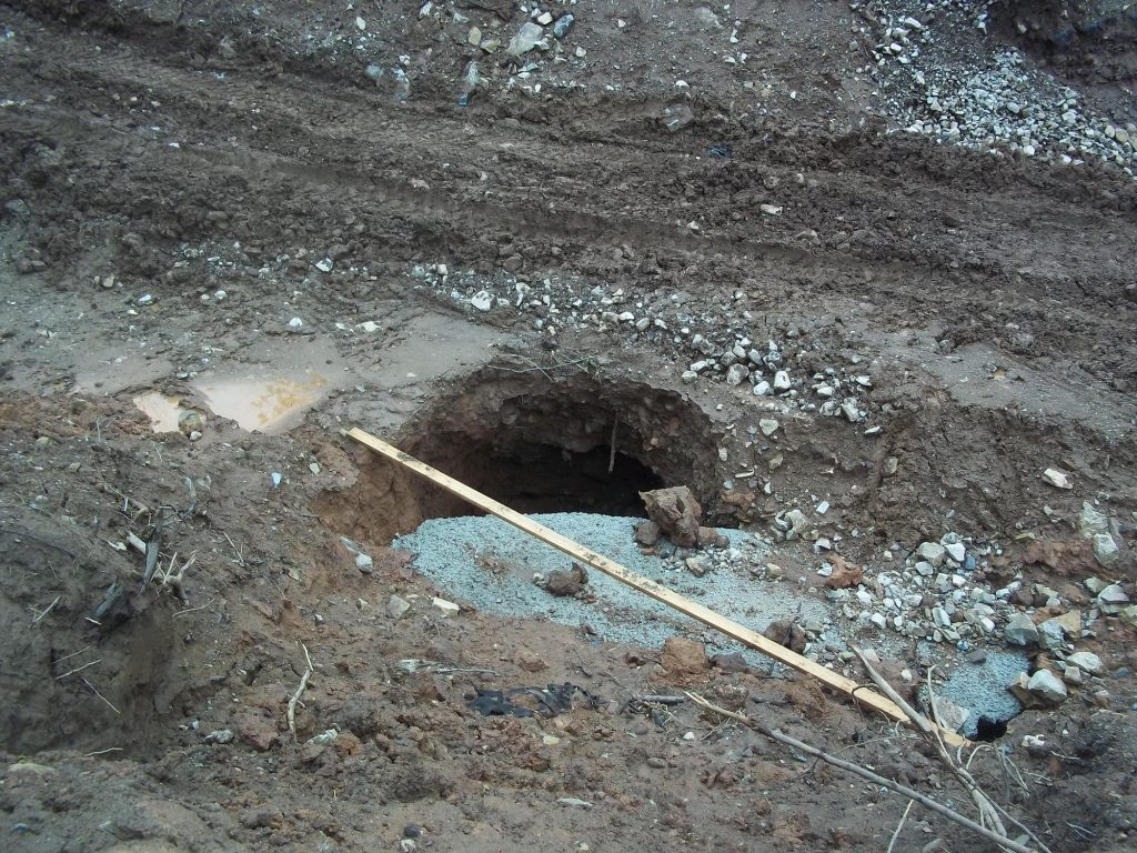
The photographs of the sinkholes and landscape at the site of the former Plymouth Road Bridge are courtesy of Loftus Construction, Inc., 2015.
The photographs of the new Plymouth Road Bridge at the time of its opening and at the time of the ribbon-cutting ceremony are courtesy of the Pennsylvania Department of Transportation, 2015.
Do you have questions about local history? A street name? A building?
Your questions may be used in a future news column.
Contact Richard McDonough at freedomvalleychronicles@gmail.com.
© 2018 Richard McDonough