
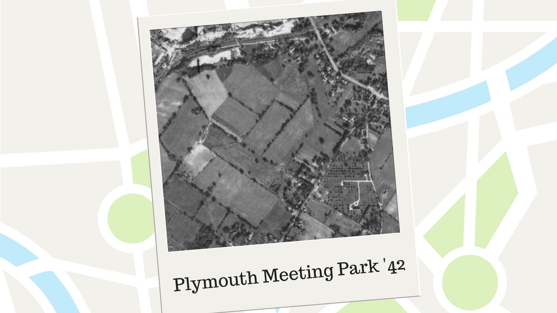
The photograph above shows what today is the Plymouth Meeting Park neighborhood as it looked on October 8, 1942. The roadway that goes from the top in the upper left to the right-side of the photo is Germantown Pike.
Where you see a concentration of trees near the right-side of the photo is where Butler Pike intersects with Germantown Pike. The road that is near the top of the photo, from the left-side of the photograph to Germantown Pike, is Chemical Road.
In between Germantown Pike, Butler Pike, and Chemical Road are the farmlands that became Plymouth Meeting Park. Hedgerows of trees separated areas of the farmlands.
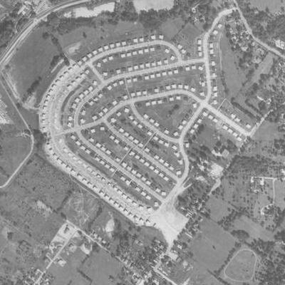
In the photograph above, taken on September 23, 1958, shows how the farmlands were transformed into a housing development. Germantown Pike appears in the same location as seen in the top photo, with Butler Pike going from the middle of the bottom of the photo to the middle of the left-side of the photograph.
Shasta Road has not yet been built out to its intersection with Butler Pike though you can see the land has been scraped bare in preparation for the roadway. The vacant land on the left-side of photo near the bottom is the future site of the Ridge Park Elementary School.
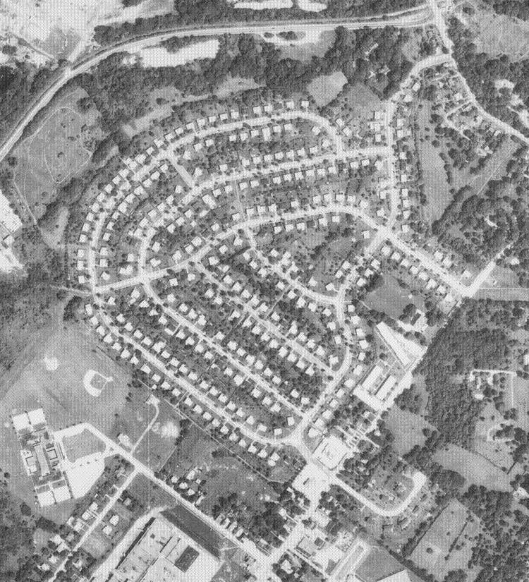
This aerial photo was taken on August 6, 1971. Many of the housing lots now have mature trees. The land along Chemical Road, seen along the top of the photo, remains largely vacant at this time.
The lower left-side of the photo shows the Ridge Park Elementary School, including a baseball field and the school’s parking lot. Opened in 1962, this school was built to help educate the large number of children moving into Plymouth Township at that time. Classes for grades one through six were provided at this new school.
Prior to the construction of Ridge Park Elementary School, many children in the area were educated in elementary grades at the Plymouth Consolidated School. Even with the opening of Ridge Park Elementary School, Plymouth Consolidated School – located on the land that now houses the Harmonville Fire Company on Butler Pike – continued to educate children. Almost all children attending kindergarten classes in Plymouth Township attended those classes at Plymouth Consolidated School.
The Plymouth Square Shopping Center can be seen at the bottom of the photo, with Karrs Lane seen just above the shopping center and Little Avenue seen to the left of the shopping center.
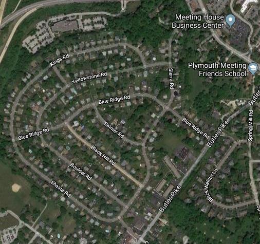
Plymouth Meeting Park as it is today can be seen in the photograph above. The roadways in this map are identified by name. Newer construction – as compared to the houses built in the 1950’s in Plymouth Meeting Park as well as many of the original houses that are more than 150 to 200 years old along Germantown and Butler Pikes – can also be seen in this photo. A large office building – off of Chemical Road – is near the top of this photo, while a housing development can be seen off of Spring Mill Road in Whitemarsh Township.
(The first three map photos are courtesy of the United States Department of Agriculture and the Pennsylvania Geological Survey, 1942, 1958, and 1971, while the bottom map photo is courtesy of Google, 2017)
Do you have questions about local history? A street name? A building?
Your questions may be used in a future news article.
Contact Richard McDonough at freedomvalleychronicles@gmail.com.
© 2017 Richard McDonough