
Butler Pike – initially known as “Butler Road” – got its name from Mr. Simon Butler who helped create what became Chalfont in Bucks County. According to the Borough of Chalfont, Mr. Butler purchased land in what is present-day Chalfont and New Britain. His initial purchase included 150 acres of land bought in 1720.
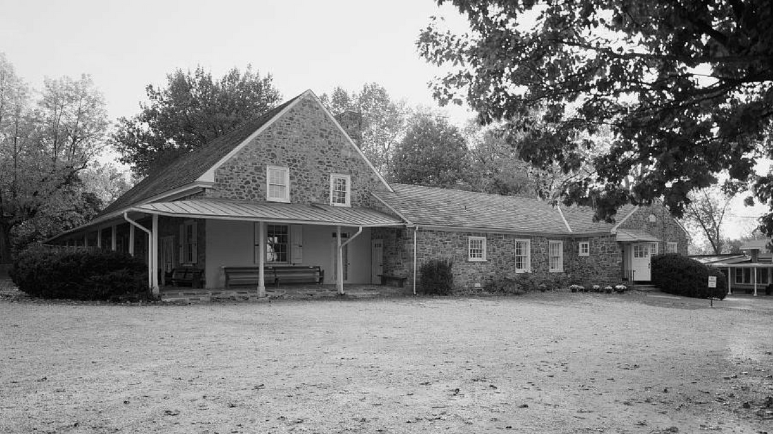
Pictured above is The Plymouth Friends Meetinghouse as seen in 1933. This religious building is located at Butler and Germantown Pikes in Plymouth Meeting. The village took its name from the Plymouth Monthly Meeting of the Society of Friends.
Mr. Butler built a mill – “Butler’s Mill” – as well as “oversaw the construction of roads including Butler Pike,” according to the Borough. It is that mill that helped give Butler Road/Butler Pike its name, according to the Wissahickon Valley Historical Society.
At one point, according to the Borough, what is now known today as “Chalfont” was a village known as “Butler’s Mill”.
Through development, Butler Road traveled over several roadways from Chalfont to the Village of Wissahickon (now known as “Ambler”) and through the Freedom Valley communities of Broad Axe, Cold Point, Plymouth Meeting, Harmonville, and Conshohocken.
As noted in a previous edition of The Freedom Valley Chronicles, two separate turnpikes operated on sections of what is today known as “Butler Pike”. In earlier years, this roadway was also known as “Township Line Road”.
The Whitemarsh and Plymouth Turnpike used to exist between Plymouth Meeting and Conshohocken. According to a news article in The Philadelphia Times on December 14, 1895, the Whitemarsh and Plymouth Turnpike Company was incorporated in 1848. At the time of its construction in 1849, the turnpike served as the boundary between Plymouth and Whitemarsh Townships. There were two toll gates on the turnpike – one at Harmanville (today spelled as “Harmonville”) and one at the Conshohocken Borough boundary line with Plymouth and Whitemarsh Townships.
A court, according to the news article in The Philadelphia Times, appointed a master in proceedings on December 13, 1895, to free the Whitemarsh and Plymouth Turnpike. The company that owned this turnpike was dissolved in May of 1896, according to a news article in The Philadelphia Inquirer on May 24, 1896. This news article reported that holders of stock in the Whitemarsh and Plymouth Turnpike Company received $56.80 per share; the par value of the stock was listed at $50.00 at that time.
When the turnpike was freed, the roadway became “Butler Pike” between Germantown Pike in Plymouth Meeting and the Conshohocken Borough boundary line while “Fayette Street” became the sole name for the roadway within the Borough of Conshohocken.
The Upper Dublin and Plymouth Turnpike Road Company created a turnpike on what is today known as “Butler Pike” from Germantown Pike in Plymouth Meeting to Limekiln Pike in Upper Dublin Township. According to Bean’s History of Montgomery County, what was then called “Township Line Road” became a turnpike in 1855; an historical document from the University of Pennsylvania indicates that the turnpike company itself was incorporated in 1853.
The Philadelphia Times reported that a master and jury were appointed on December 14, 1895, to condemn the Upper Dublin and Plymouth Turnpike from Plymouth Meeting to Ambler. (The portion of the turnpike within the Borough of Ambler had already been freed from tolls.) According to a news article in The Philadelphia Times on May 13, 1896, this turnpike was freed by Montgomery County the day before. A payment of $2,944.00 was ordered paid to the company that owned the turnpike by order of a county jury.
The image of the Plymouth Friends Meetinghouse is courtesy of the Library of Congress, 1933.
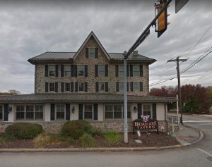
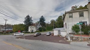
The images of the Broad Axe Tavern and Cold Point Hill Road are courtesy of Google, 2017.
Do you have questions about local history? A street name? A building?
Your questions may be used in a future news article.
Contact Richard McDonough at freedomvalleychronicles@gmail.com.
© 2018 Richard McDonough