
The lands now included within the limits of the Borough of Conshohocken were formerly parts of Plymouth Township and of Whitemarsh Township. The Borough was incorporated as a distinct municipality in 1850.
Originally, the Borough of Conshohocken included 640 acres – one square mile of land. Half of that acreage came from Plymouth, half came from Whitemarsh. What is now known as “Fayette Street” was the dividing line between the two townships before the incorporation of Conshohocken as a separate municipality.
There have been at least six times when there were earnest efforts to expand the size of the Borough. Two of those efforts were successful; four were not.
When the initial boundaries of the Borough were laid, three of the four border lines were straight lines. One line separated the Borough from Plymouth and went from the Schuylkill to what would eventually become the path of the 12th Avenue alignment, one line separated the Borough from both Plymouth and Whitemarsh and went along the path of the 12th Avenue alignment, and one line separated the Borough from Whitemarsh and went from the 12th Avenue alignment to the Schuylkill. The fourth line followed the path of the Schuylkill.
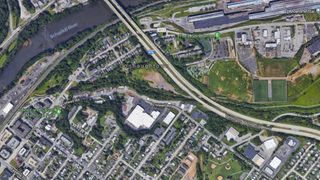
That first line – the straight line border between Plymouth and Conshohocken – cut through the Foulke Farm near the Schuylkill. That farm eventually got developed as Connaughtown. Today, this section of the border between the two municipalities divides a number of housing lots and other properties.
As it left the area of the Foulke Farm, the straight line border continued through other private property to the 12th Avenue alignment. That initial border was located about 80 to 100 feet from what is now Colwell Lane.
In 1850, that initial straight line border through farmland and forest was not seen as a big deal. As Conshohocken developed, though, the boundary in this area became a major problem for the Borough.
The government of Conshohocken was only able to consider potentially building its numbered avenues – 5th Avenue through 12th Avenue – to specific points where the avenues would end in fields as dead-end roadways. The Borough could not consider building these numbered avenues to Colwell’s Lane – today’s “Colwell Lane” – because there was a sliver of land under the control of the government of Plymouth Township between the straight line border and Colwell Lane. Both sides of Colwell Lane in this area were under the jurisdiction of Plymouth Township.
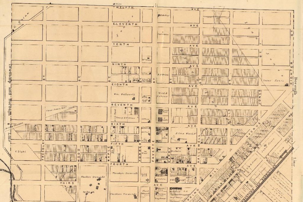
This map from 1871 shows portions of the initial boundary lines for the Borough of Conshohocken. On the left side of the map, notice the line that juts out from Conshohocken between the 4th and 5th Avenue alignments and then juts back into Conshohocken between the 10th and 11th Avenues alignments. That line was Colwell’s Lane – much of that roadway is today’s Colwell Lane. The land between this section of Colwell Lane and the official border between Conshohocken and Plymouth was governed as part of Plymouth Township.
That sliver of land was about 80 to 100 feet wide. The specific distance is uncertain. The Conshohocken Recorder indicated the straight-line border ended about 80 feet from Colwell Lane. Montgomery County land records appear to indicate that the distance may have been about 100 feet. Nonetheless, it was not a substantial distance.
This border situation lasted for more than 75 years.
Two of the avenues did get built out to Colwell Lane – traversing lands under the control of Plymouth Township government – through private actions. According to an editorial in the Conshohocken Recorder published on July 6, 1926, both 6th and 10th Avenues had been built out to Colwell Lane, “the latter avenue being opened and finished at private expense.”
The editorial noted that the expansion of the Borough to Colwell Lane would allow additional avenues to be opened which “would divert much traffic from Fayette, Hector, and Elm Streets.” In addition, the editorial detailed the benefits to the Borough to handle surface water runoff from the eventual development in the area.
In 1926, the Borough of Conshohocken officially took steps to change its border with Plymouth Township.
The initial reaction from the Borough Council was not enthusiastic.
The Conshohocken Recorder reported in a news article dated April 16, 1926, that Conshohocken Realty Corporation first asked “several months ago” for the annexation of the land from the current border to Colwell Lane. According to the newspaper, the real estate company owned all of the land in this narrow strip. The firm again publicly petitioned the Borough Council on April 14, 1926, to annex the land.
The newspaper reported that Conshohocken Realty Corporation agreed to cover the costs that would be incurred by the Borough to annex this section of Plymouth Township.
One council member, according to the Conshohocken Recorder, was opposed to the annexation; his view was that the Borough was not properly maintaining the streets it already had under its control and the annexation would just add another burden to the Borough. The matter was referred to the solicitor for review to “make a report at the next meeting” of the Borough Council.
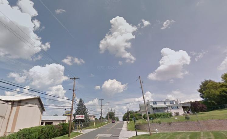
Prior to 1926, both sides of Colwell Lane between about the 5th Avenue alignment and the 12th Avenue alignment were within Plymouth Township. This photograph shows Colwell Lane near 6th Avenues in 2017. Today, Plymouth Township includes the lands to the left of the center line of this section of Colwell Lane; Conshohocken Borough includes the properties to the right of the center line of this section of the roadway.
According to the Borough of Conshohocken, the ordinance to annex the land from Plymouth was approved by the Borough Council on July 16, 1926.The Conshohocken Recorder reported in a news article dated November 5, 1926, that the Borough of Conshohocken had officially grown by a little more than 5 acres through the annexation of the narrow piece of Plymouth Township. The vacant land and a total of 9 houses were transferred from governmental oversight by Plymouth to the jurisdiction of Conshohocken. (It is not certain if Conshohocken Realty Corporation owned the 9 houses or if the firm just owned the vacant land.)
In Part Two, we’ll review how the Borough of Conshohocken expanded its initial borders with the annexation of additional land from Whitemarsh Township in 1968.
The top photograph of western Conshohocken is courtesy of Google, 2018.
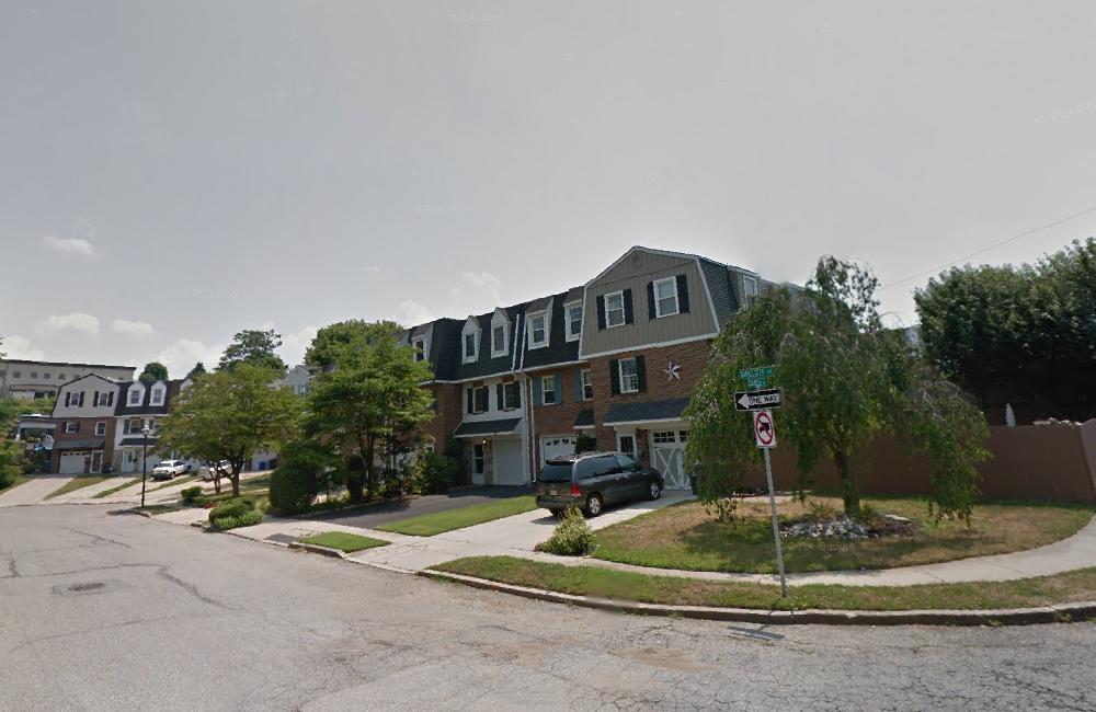
The photograph of Sutcliffe Lane is courtesy of Google, 2012.
The map is a portion of a map from 1871 courtesy of the Commonwealth of Pennsylvania Historical and Museum Commission.
The photograph of Colwell Lane is courtesy of Google, 2017.
Do you have questions about local history? A street name? A building?
Your questions may be used in a future news article.
Contact Richard McDonough at freedomvalleychronicles@gmail.com.
© 2018 Richard McDonough