
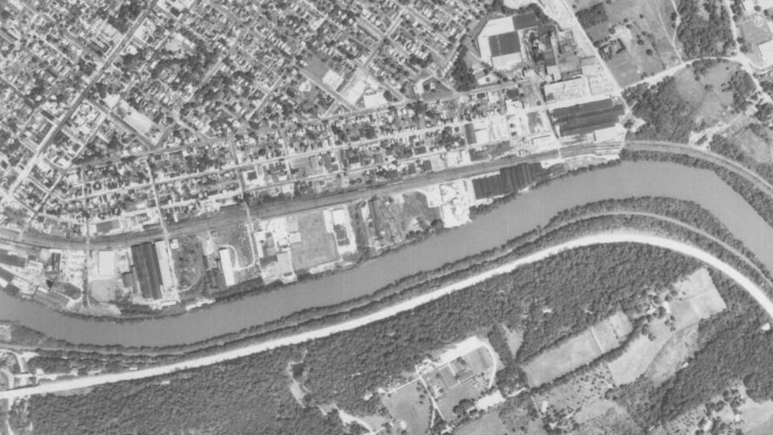
This is an aerial view of a portion of Conshohocken and its immediate neighbors on August 6, 1971. The Schuylkill can be seen separating Conshohocken and Whitemarsh, at the top of this photo, from West Conshohocken and Lower Merion, on the bottom of the photograph. The wide white line that goes from the lower left of the photo and curves to the lower right is the Schuylkill Expressway.
Industrial buildings and warehouses were the primary uses for the lands along the Schuylkill within Conshohocken from Fayette Street, seen in the far left of this photo, to the bend of the Schuylkill in Spring Mill in Whitemarsh. Much of this same area has since been redeveloped as sites for office buildings and residential housing complexes. The middle part of this industrial area was eventually developed as Millennium through the years.
The aerial photographs displayed in the rest of this news column focus on the development and re-development of Millennium in this section of Conshohocken. This was the location where the Millennium Fire began on August 13, 2008. From its beginning at the construction site of Stables At Millennium, this fire devastated the area.
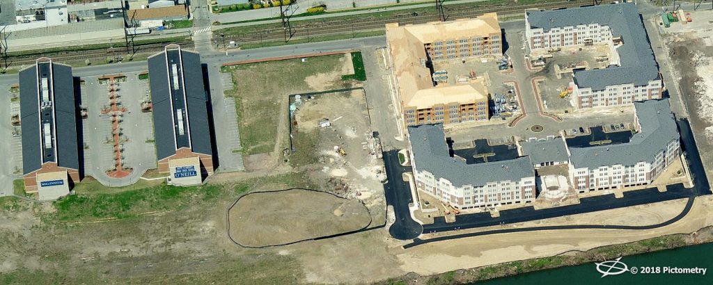 This photograph from April of 2005 shows Millennium III Offices to the left and Riverwalk At Millennium, a residential rental complex, to the right. The empty land in between the two developments is the future site of Stables At Millennium, a planned apartment complex.
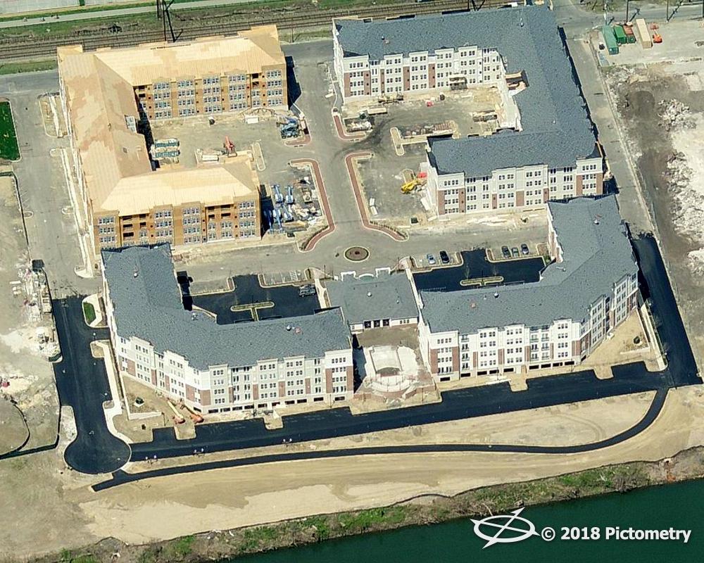 This aerial view shows a close-up of Riverwalk At Millennium under construction in April of 2005. Washington Street is at the top of the photograph, with the Schuylkill at the bottom of the photo. Macadam pavement has been laid for access to the two buildings closest to the river.
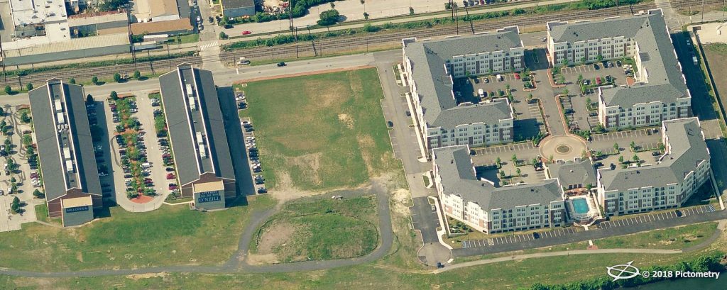 This photograph shows offices occupied at Millennium III, to the left, and residential rental units occupied at Riverwalk At Millennium, to the right, in May of 2007. Grass has now grown throughout much the empty lot between the two developments as well as the areas along the Schuylkill, unseen at the bottom of much of this photo. The empty lot eventually became the construction site of Stables At Millennium.
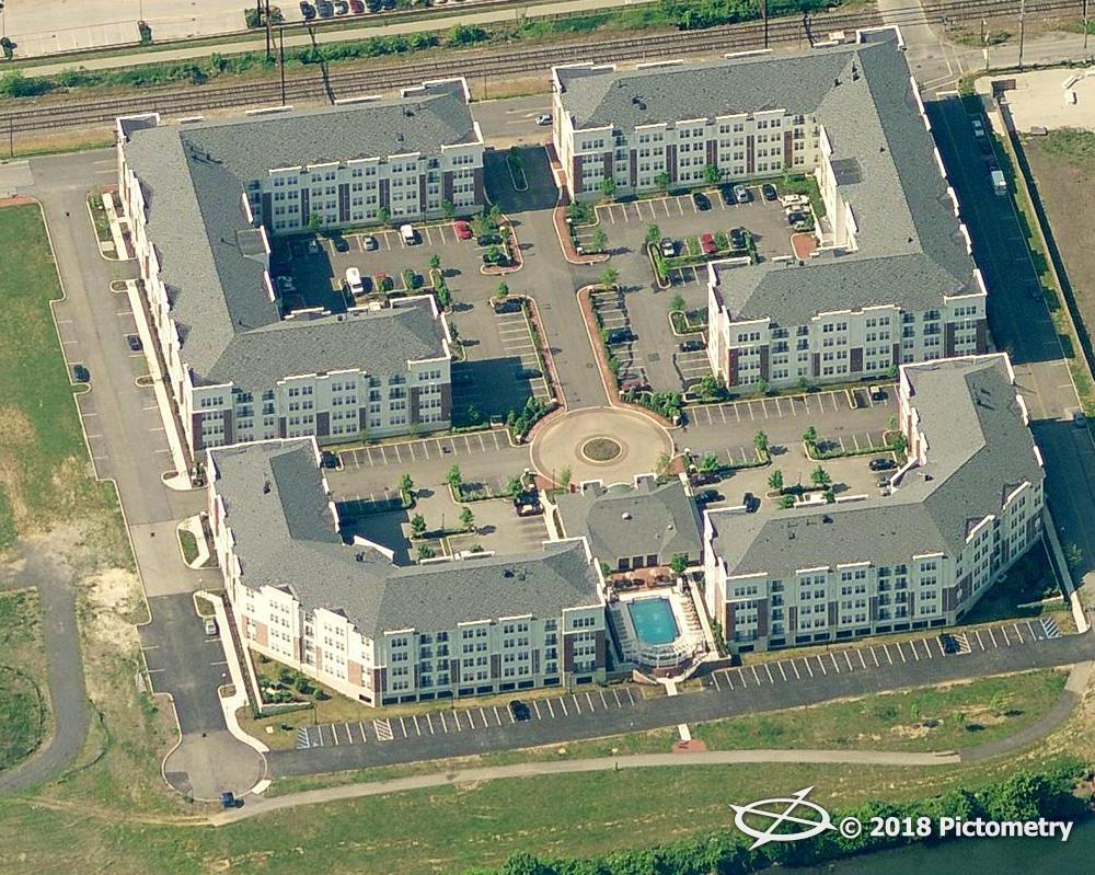 Riverwalk At Millennium as seen from the air in a close-up in May of 2007. Washington Street and the SEPTA railroad tracks can be seen at the top of this photo. The banks of the Schuylkill can be seen in the lower right of the photograph.
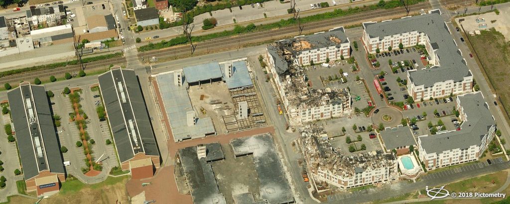 This is what a section of Conshohocken looked like from the air after the Millennium Fire in August of 2008. Note the blackened building structures in the middle of this photograph. This was the construction site of Stables At Millennium. The photograph also shows the devastation at two of the buildings at Riverwalk At Millennium. Millennium III Offices are the two buildings to the left in this photo.
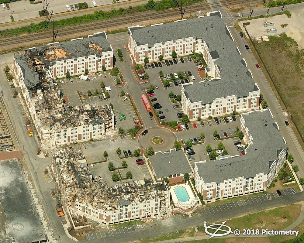 This photograph shows a close-up of the damage that had been done to Riverwalk At Millennium in August of 2008. Two of the buildings were substantially damaged at this residential rental complex. These two buildings were eventually demolished. The blackened structure to the left is one of the foundations that remained after the Millennium Fire at the site of the fire, Stables At Millennium.
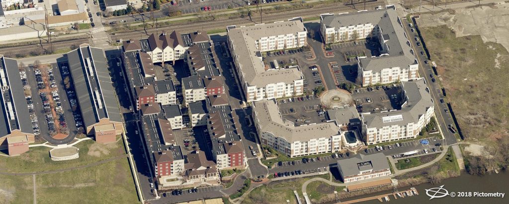 This aerial view from April of 2017 shows, from left to right, Millennium III Offices, Londonbury At Millennium, and Riverwalk At Millennium. Londonbury At Millennium, a residential rental complex, was built on the site that was to be Stables At Millennium; this was the site of the Millennium Fire on August 13, 2008. The empty lot, seen to the right, is the site of planned future development in Conshohocken.
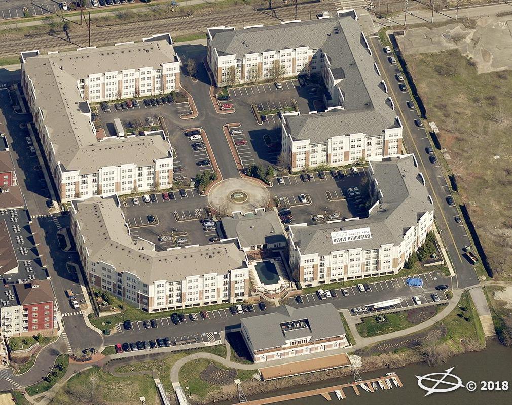
This photograph shows a close-up of Riverwalk At Millennium in April of 2017. The white sign on the roof of one of the buildings indicates that newly renovated units were available for rent in this residential rental complex in the Spring of 2017.
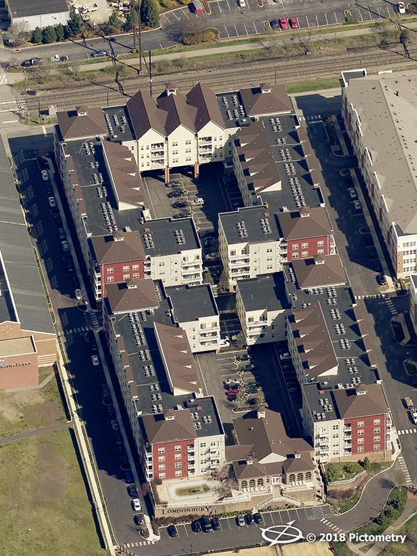 Londonbury At Millennium as seen in a close-up from the air in April of 2017. This was where the Millennium Fire started at construction site of Stables At Millennium on August 13, 2008.
The top aerial photo is courtesy of the United States Department of Agriculture and the Pennsylvania Geological Survey, 1971.
All of the other aerial photographs were produced by and are provided courtesy of Pictometry International Corp., 2005, 2007, 2008, and 2017.
Do you have questions about local history? A street name? A building?
Your questions may be used in a future news column.
Contact Richard McDonough at freedomvalleychronicles@gmail.com.
© 2018 Richard McDonough