
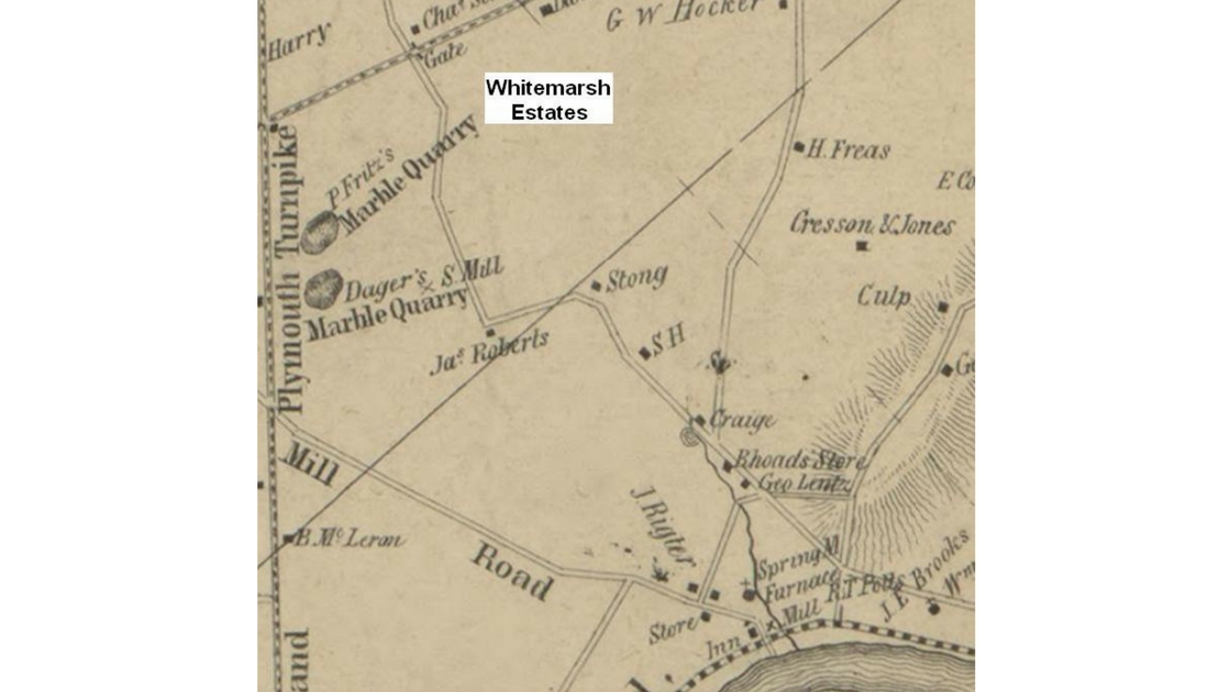
The land that now includes Whitemarsh Estates was utilized as farmland for years. This map shows the approximate location of today’s neighborhood in 1849. Where you see the word “Gate” near the top of the map was the site of a tollbooth (tollgate) on the Ridge Turnpike (dotted line on this map). In years past, travelers had to pay to travel on the Ridge Turnpike from Philadelphia through the Freedom Valley and Montgomery County. The roadway that is next to “Gate” on this map is what is called “Spring Mill Road” today. Note that Spring Mill Road went directly to the Village of Spring Mill (in the lower right-side of this map). Today, a section of what was this roadway is now called “Cedar Grove Road”.
In this map, North Lane was called “Spring Mill Road”; on the map, the wording “Mill Road” is displayed. The wording “Plymouth Turnpike” on the left side of the map is a portion of the name used at times – “Whitemarsh and Plymouth Turnpike” – for today’s Butler Pike.
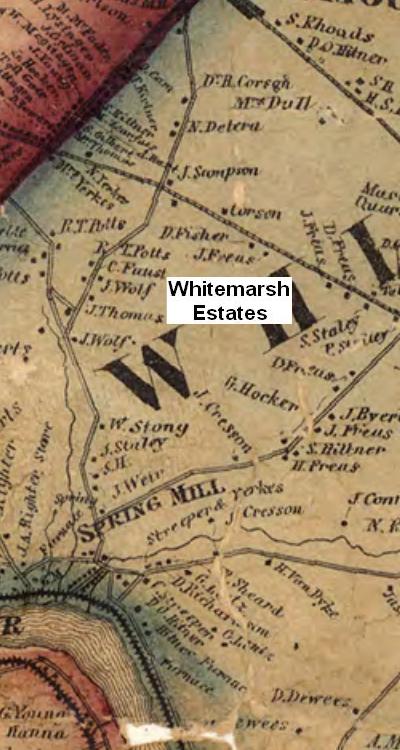
This map from 1860 shows the general location of today’s Whitemarsh Estates. The map shows that today’s Cedar Grove Road had been opened – from today’s Butler Pike to its intersection with today’s Spring Mill Road – by the time this map was prepared. The Ridge Turnpike – the dotted line going from left to right on the map – was still a toll road traveling through Whitemarsh Township.
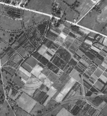
Ridge Pike – no longer a toll turnpike – is seen in this aerial map from October 8, 1942; the road is the white wide line from the left top of the photo to the right side of the photograph. The area now occupied by Whitemarsh Estates is seen divided into a number of separate farm plots in this aerial map. Much of this section of Whitemarsh Township was still actively used for agricultural purposes. Spring Mill Road is the street from the center top of this photo to the lower left-side of the photograph.
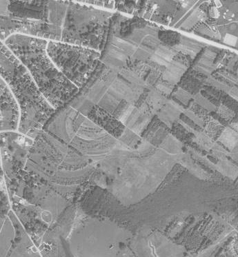
Whitemarsh Estates is still farmland in this aerial photograph taken on September 23, 1958. By this date, development was transforming Whitemarsh Township from a rural municipality with several villages into a residential suburb with sections that retain a rural flavor. Cedar Grove Road is the roadway from the lower left-side of the photograph to the bottom of the photo. Spring Mill Road is the street from the center top of this photo to the lower left-side of the photograph.
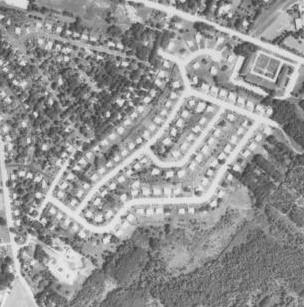
The neighborhood of Whitemarsh Estates was fully built out by the time this photo was taken on August 6, 1971. The streets in this community can be seen as wide white lines in this image. Few mature trees have yet provided cover along the streets in this neighborhood. Ridge Pike is the wide white line from the center of the top of the photo to near the top of the right-side of the photograph. Cedar Grove Road is the roadway from the middle of the left-side of the photo to the bottom of the photo. Spring Mill Road is the street from the center top of this photo to near the lower left-side of the photograph.
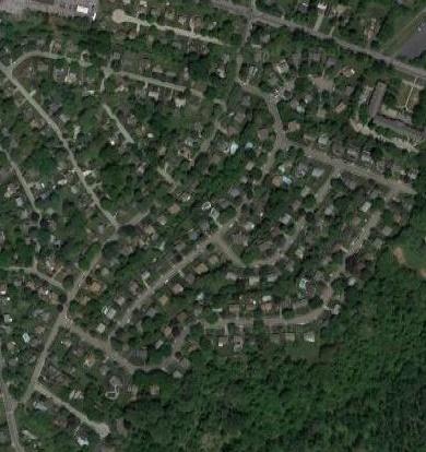
Tree cover is now seen throughout Whitemarsh Estates in this aerial photo from 2018. Ridge Pike is the roadway that is displayed in this photo from the center top to the right-side. Spring Mill Road is the street from the center top in the photograph to the lower left-side in the photo.
The top image displayed here is a portion of a map from 1849 courtesy of the Library of Congress.
The second image displayed in the news article is a portion of a map from 1860 courtesy of the Commonwealth of Pennsylvania Historical and Museum Commission.
The first three aerial photos are courtesy of the United States Department of Agriculture and the Pennsylvania Geological Survey, 1942, 1958, and 1971, while the bottom aerial photo is courtesy of Google, 2018.
Do you have questions about local history? A street name? A building? Your questions may be used in a future news article.
Contact Richard McDonough at freedomvalleychronicles@gmail.com.
© 2018 Richard McDonough