
There used to be two additional Township Line Roads in the Freedom Valley. In years past, First Avenue previously was Front Avenue, Front Street used to be Schuylkill Road, and First Alley used to be Front Street. There used to be a second Spring Mill Road. One area road had two separate turnpikes. Confused? Read on for details on some of the roadways that have previously had other names in the Freedom Valley.
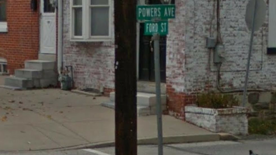
Powers Avenue was formerly known as “First Alley”. There appeared to be two reasons for the name change of this roadway by the Borough of West Conshohocken. One was to remove the confusion that existed for postal mail deliveries between First Alley in West Conshohocken and First Avenue in the Borough of Conshohocken. While the roads were in two different municipalities, both streets shared the same postal district and zip code.
The second reason for the name change was to honor Mr. Joseph Powers. Mr. Powers was a resident of West Conshohocken and was a volunteer fire fighter with the George Clay Fire Company. In 1971, Mr. Powers lost his life in the line of duty as he fought the fires that erupted because of the natural gas explosions that rocked Front Street.
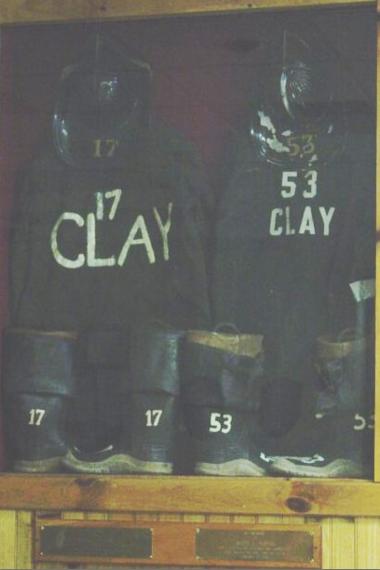
Mr. Powers – number 53 – is honored for his service to the community at this memorial display case at the George Clay Fire Company. Two members of this fire company have died in the line of duty. The second fire fighter, Mr. William Evans, was number 17; he was killed by a motor vehicle as he raced to respond to a fire call in 1965. According to the fire company, the gear of both men will never be used again.
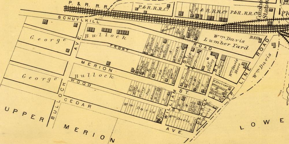
There were several name changes of streets in West Conshohocken through the years. The map above, from 1871, shows the initial plan for the development of West Conshohocken.
Prior to being known as “Powers Avenue” and “First Alley”, this street was known as “Front Street”. Note that the roadway listed as “Schuylkill Road” on this map is now known as “Front Street”. At some point, the name “Front Street” was switched from what is today known as “Powers Avenue” to what was initially known as “Schuylkill Road”.
At the time of this map, the Borough of West Conshohocken did not exist as a separate municipality. Instead, the lands now part of the Borough were then part of Upper Merion and Lower Merion Townships. What is known today as “Ford Street” was then known as “Township Line Road”. That street name came from the fact that the roadway was, for the most part, the boundary between the two townships.
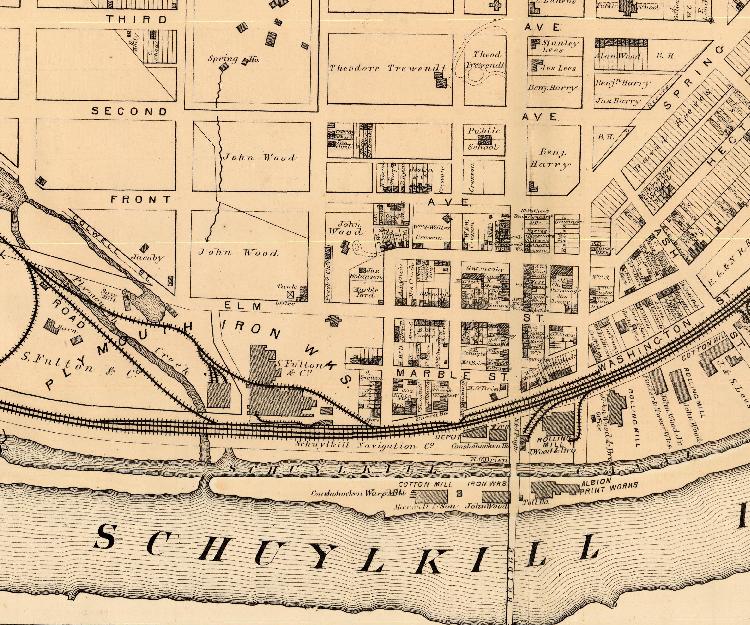
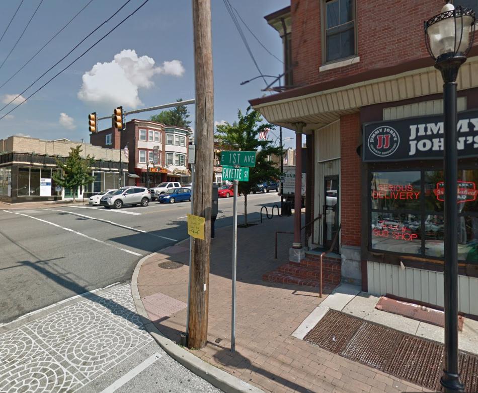
First Avenue in Conshohocken previously was known as “Front Avenue”. The map above shows a portion of the layout of the streets in the Borough of Conshohocken as of 1871.
North Lane in Plymouth and Whitemarsh Townships received its name from the fact that it heads north from the Village of Spring Mill. Previously, this roadway was known as “Spring Mill Road”.
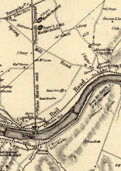
This map, from 1848, shows North Lane when it was previously known as “Spring Mill Road” and Fayette Street and Butler Pike when both were previously known as the “Whitemarsh and Plymouth Turnpike”.
Two separate turnpikes operated on sections of what is today known as “Butler Pike”. In earlier years, this roadway was known as “Township Line Road”.
The Whitemarsh and Plymouth Turnpike used to exist between Plymouth Meeting and Conshohocken. According to a news article in The Philadelphia Times on December 14, 1895, the Whitemarsh and Plymouth Turnpike Company was incorporated in 1848. At the time of its construction in 1849, the turnpike served as the boundary between Plymouth and Whitemarsh Townships. There were two toll gates on the turnpike – one at Harmanville (today spelled as “Harmonville”) and one at the Conshohocken Borough boundary line with Plymouth and Whitemarsh Townships.
A court, according to the news article in The Philadelphia Times, appointed a master in proceedings on December 13, 1895, to free the Whitemarsh and Plymouth Turnpike. The company that owned this turnpike was dissolved in May of 1896, according to a news article in The Philadelphia Inquirer on May 24, 1896. This news article reported that holders of stock in the Whitemarsh and Plymouth Turnpike Company received $56.80 per share; the par value of the stock was listed at $50.00 at that time.
When the turnpike was freed, the roadway became “Butler Pike” between Germantown Pike in Plymouth Meeting and the Conshohocken Borough boundary line while “Fayette Street” became the sole name for the roadway within the Borough of Conshohocken.
The Upper Dublin and Plymouth Turnpike Road Company created a turnpike on what is today known as “Butler Pike” from Germantown Pike in Plymouth Meeting to Limekiln Pike in Upper Dublin Township. According to Bean’s History of Montgomery County, what was then call “Township Line Road” became a turnpike in 1855; according to historical document from the University of Pennsylvania, the turnpike company itself was incorporated in 1853.
The Philadelphia Times reported that a master and jury were appointed on December 14, 1895, to condemn the Upper Dublin and Plymouth Turnpike from Plymouth Meeting to Ambler. (The portion of the turnpike within the Borough of Ambler had already The image of the memorial case at the George Clay Fire Company is courtesy of that fire company.
The map of West Conshohocken is a portion of a map from 1871 courtesy of the Commonwealth of Pennsylvania Historical and Museum Commission.
The map of Front Avenue in Conshohocken is a portion of a map from 1871 courtesy of the Commonwealth of Pennsylvania Historical and Museum Commission.
The image of First Avenue in Conshohocken is courtesy of Google, 2017.
The map of Spring Mill Road and the Whitemarsh and Plymouth Turnpike is a portion of a map from 1848 courtesy of the Commonwealth of Pennsylvania Historical and Museum Commission.
Do you have questions about local history? A street name? A building?
Your questions may be used in a future news article.
Contact Richard McDonough at freedomvalleychronicles@gmail.com.
© 2018 Richard McDonough