
In July, The Freedom Valley Chronicles detailed how the maps of the Borough of Conshohocken utilized by both the Borough government and by the Pennsylvania Department of Transportation (PennDOT) were likely incorrect.
The Borough of Conshohocken has yet to respond to the indications that its official maps for zoning and for the wards of the Conshohocken Borough Council are incorrect.
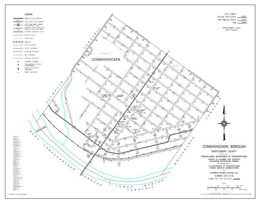
PennDOT, though, has changed its maps utilized for the Liquid Fuels Tax. The maps for both the Borough of Conshohocken and for Whitemarsh Township have now been updated to reflect land that was annexed by the Borough from the Township 50 years ago.
The new map issued by PennDOT on September 25, 2018, is displayed above.
For the first time, the “B” Field, also known as the “John Borusiewicz Memorial Field”, is now officially recognized by PennDOT as part of the Borough. This recreational facility has been owned by the Borough for decades even though the land was for much of its history officially part of Whitemarsh Township. In 1968, this parcel of land officially became part of the Borough of Conshohocken.
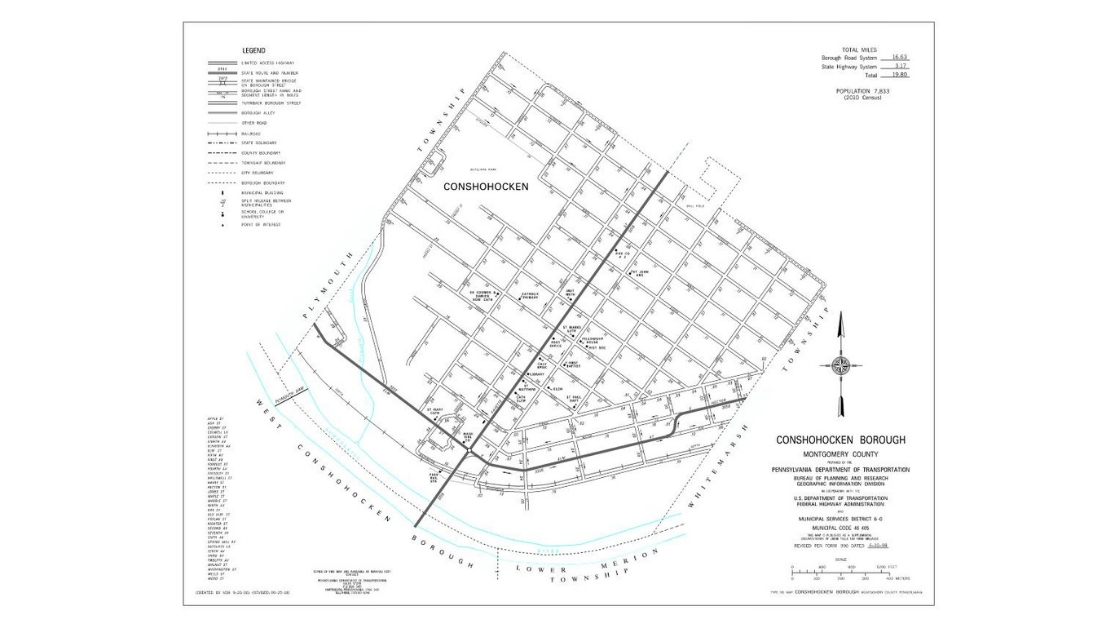
This was the previous map utilized by PennDOT. Note that this map did not include the “B” Field within the borders of the Borough of Conshohocken. This recreational facility had been annexed to the Borough from Whitemarsh Township in 1968.
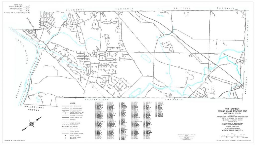
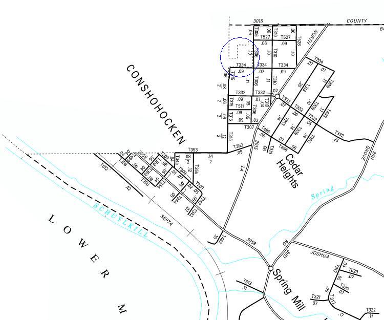
As part of the efforts to correct the map of the Borough of Conshohocken, PennDOT also corrected the map of Whitemarsh Township. A small portion of the Township containing the lands of the “B” Field – in the upper left-hand corner of the above map – were removed and placed within the boundary of the Borough. The map below shows the specific area – in a blue circle – that was removed from the map of the Township and added to the map of the Borough
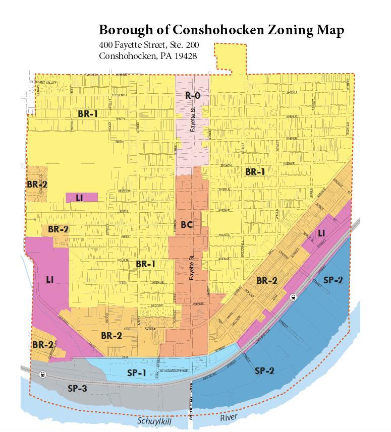
This is the zoning map that is displayed on the Borough of Conshohocken website as of November 10, 2018. The map is likely incorrect. In the upper left-hand corner of this map is a notch. According to Plymouth Township, Montgomery County, and the Commonwealth of Pennsylvania, that notch is actually part of the Borough of Conshohocken. Yet, the Borough has no official zoning for that section of its land area. In addition, this map still displays part of Whitemarsh Township – the area along one side of Righter Street on the far right of this map – as part of the Borough. Whitemarsh Township, Montgomery County, and the Commonwealth consider that area to be part of Whitemarsh Township, not the Borough of Conshohocken.
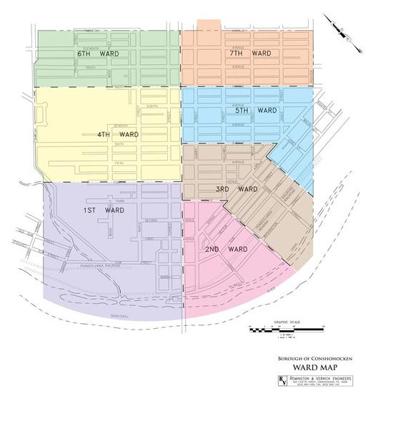
This is the ward map that is displayed on the Borough of Conshohocken website as of November 10, 2018. Like the zoning map utilized by the Borough, this map is also likely incorrect. In the upper left-hand corner of this map is a notch. According to Plymouth Township, Montgomery County, and the Commonwealth of Pennsylvania, that notch is actually part of the Borough of Conshohocken. Yet, according to this Borough map, the people who live in this notch area – and are likely part of the 6th Ward – have no representation on the Conshohocken Borough Council. Unlike the zoning map utilized by the Borough, this ward map does show the correct border between the Borough and Whitemarsh Township along Righter Street in the 7th Ward. This boundary corresponds with the border officially recognized by Whitemarsh Township, Montgomery County, and the Commonwealth.
An update to these news columns will be provided if the Borough of Conshohocken makes the decision to update its zoning map and its ward map.
You can view the initial parts of this series of news columns at:
- The Freedom Valley Chronicles: The Notch Of Conshohocken
- The Freedom Valley Chronicles: The Notch Of Conshohocken – Part Two
The maps of the Borough of Conshohocken and Whitemarsh Township from the Pennsylvania Department of Transportation (PennDOT) are courtesy of PennDOT, 2018.
The zoning map and the ward map of the Borough of Conshohocken are courtesy of that municipality, 2018.
Do you have questions about local history? A street name? A building?
Your questions may be used in a future news column.
Contact Richard McDonough at freedomvalleychronicles@gmail.com.
© 2018 Richard McDonough