
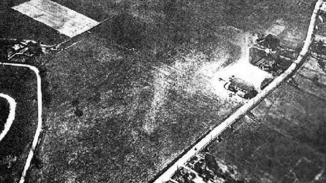
Patco Airport was located on Ridge Pike in central Plymouth Township. The name of the airport came the first letters of the first three words of its corporate owner – the Philadelphia Air Transport Company – plus the abbreviation for “company”. This aerial photo from about 1930 shows Ridge Pike from the middle of the bottom of the photograph to near the upper right-hand corner of the photo. Trees form the boundary of the air field near the top of the photograph. A hangar where planes were parked can be seen on Ridge Pike near the right side of the photo. Much of the frontage on Ridge Pike is open space or farmland at this time.
The Philadelphia Air Transport Company was incorporated on October 17, 1927, at the State Department of the Commonwealth of Pennsylvania, according to a news article in The Evening News in Harrisburg on that date. The newspaper indicated that capital stock for the business was $10,000.00.
According to the Lebanon Daily News, the Patco Flying Service applied to the Commonwealth of Pennsylvania for permission to operate airplanes and to transport passengers and freight from Plymouth Township on July 30, 1928.
On October 18, 1928, the Mount Carmel News reported that the Commonwealth approved the charter for the Patco Flying Service; the firm began with a capitalization of $50,000.00. According to this news article, Miss Mary K. Gibson of Maybrook in Wynnewood was the Treasurer of the business. The Evening News of Harrisburg indicated, in a news article on October 17, 1928, that the other incorporators of the business were Mr. J. Wesley Smith of Philadelphia and Mr. Virgil Kauffman of Yardley.
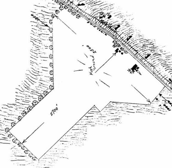
Patco Airport had about 2,500 feet of frontage on Ridge Pike. The air field extended upwards of 2,700 feet from Ridge Pike towards Conshohocken Road. Total acreage was about 76 acres. This image shows tree rows forming the boundary of Patco Airport on several borders; the remaining boundary lines were open to neighboring properties.
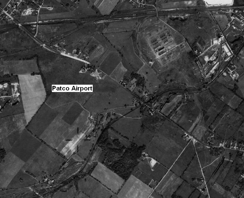
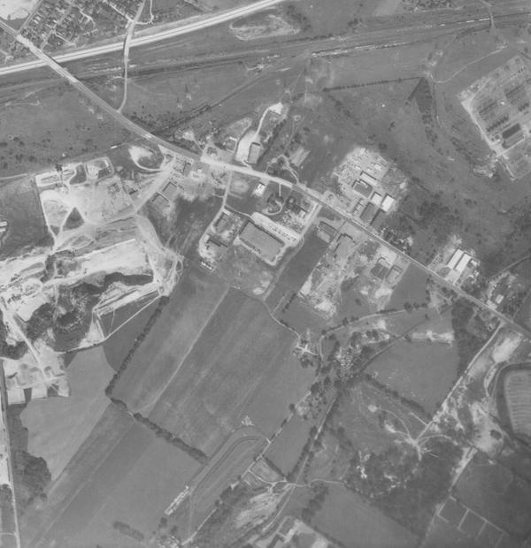
This aerial photograph was taken on October 8, 1942. Ridge Pike is lined with farms and open space for much of its frontage in central Plymouth Township. At this time, Patco Airport had limited civilian operations because of emergency regulations during World War II. Ridge Pike is seen in this photo from the top left-hand corner to the near the bottom of the right-side of the photograph.
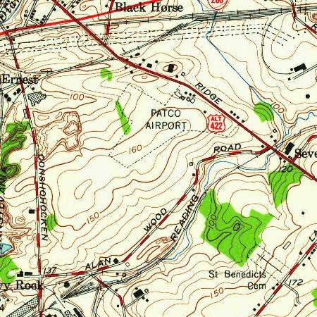
Patco Airport is noted on this topographical map of 1952. Ridge Pike at this time was Alternate Route 422. Germantown Pike was Route 422 at that time. Few buildings – depicted by little black boxes on this map – are on Ridge Pike in 1952.
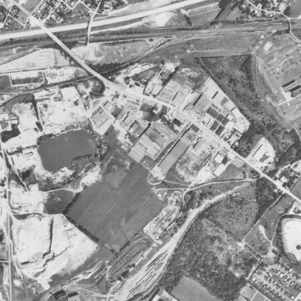
This aerial photograph was taken on September 23, 1958. The Patco Airport had been closed for a few years as of this date. Several commercial developments now line Ridge Pike in central Plymouth Township. Patco Airport was formerly located in the middle of this photo. Ridge Pike is seen in this photo from the top left-hand corner to the middle of the right-side of the photograph. The Pennsylvania Turnpike had recently been built through the Freedom Valley and is seen in this photo from the upper left-side corner to the middle of the top of the photograph. Farmland and open space still exists in this area.
This aerial photograph was taken on August 6, 1971. Ridge Pike is now lined with commercial developments for much of its frontage in central Plymouth Township. There is no trace of the Patco Airport from the air. The airport was formerly located in the middle of this photo. Ridge Pike is seen in this photo from the top left-hand corner to the middle of the right-side of the photograph. The Pennsylvania Turnpike is seen in this photo from the upper left-side corner to the middle of the top of the photograph.
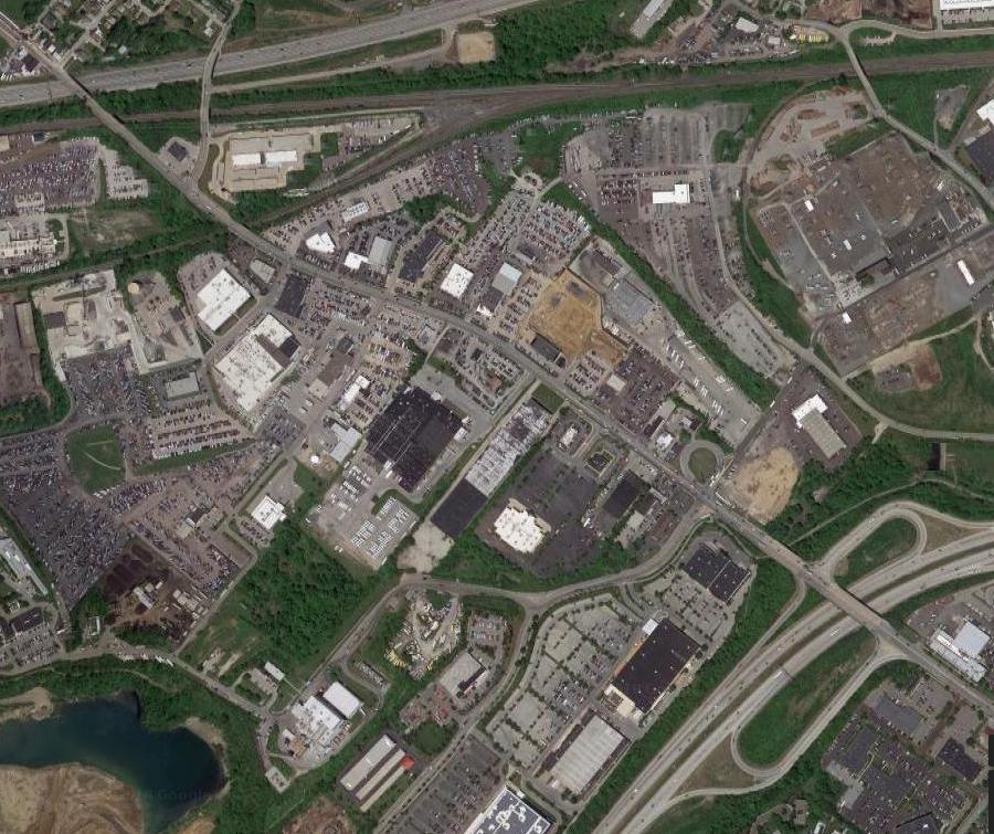
In 2018, commercial developments cover much of central Plymouth Township. There is no trace of the Patco Airport from the air. The airport was formerly located in the middle of this photo. Ridge Pike is seen in this photo from the top left-hand corner to the middle of the right-side of the photograph. The Pennsylvania Turnpike is seen in this photo from the upper left-side corner to the middle of the top of the photograph. The Ridge Pike interchange with the Mid-County Expressway (the Blue Route) is located in the lower right-hand corner of the photo.
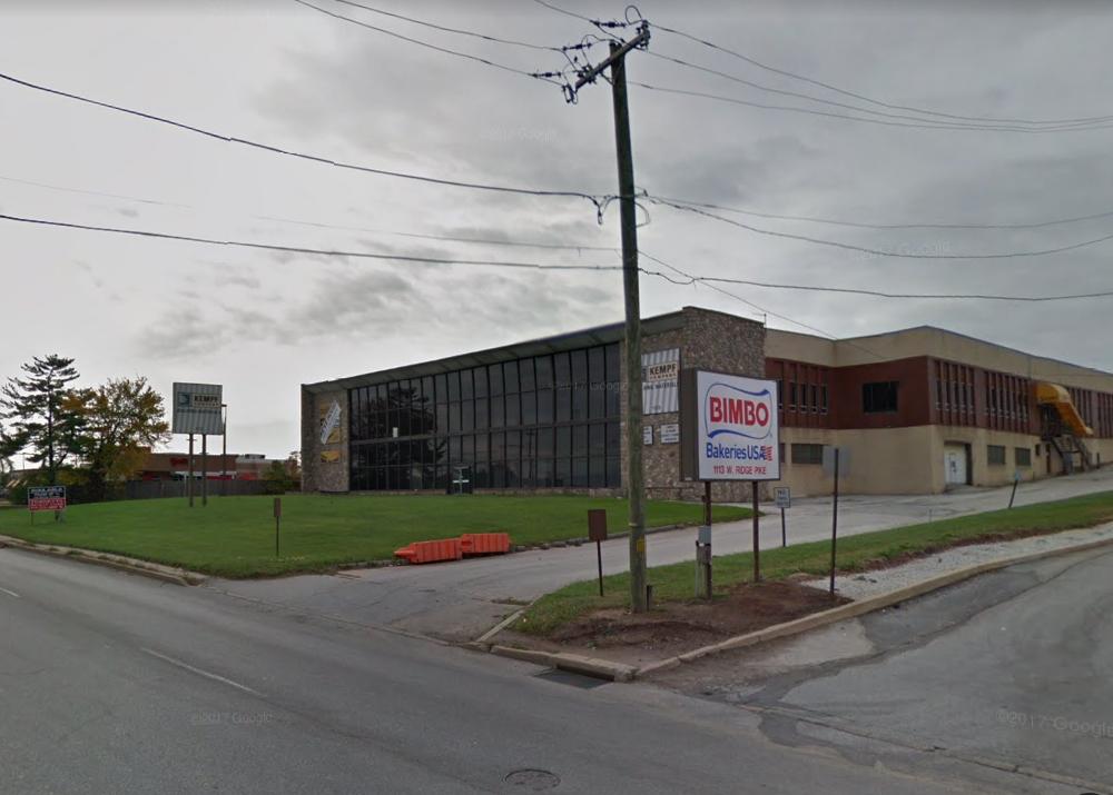
The Gettysburg Times reported in a news article on April 20, 1954, that Stroehmann Brothers Company had recently broken ground for its new bakery on about the company’s 50th anniversary at the site of what was previously Patco Airport. This new bakery eventually replaced a previous bakery operated by the company in Norristown. The building pictured above is just one of a number of commercial buildings that now occupy lands once part of the airport.
Stroehmann Brothers Company was founded on April 5, 1924, according to a news article in the Altoona Mirror dated April 17, 1954; the newspaper indicated that the firm began with the acquisition of one bakery plant in Williamsport. According to a news article in The Evening Times of Sayre on November 6, 1947, Stroehmann Brothers Company purchased a bakery in Norristown in 1928. The news article in the Altoona Mirror indicated that Stroehmann Brothers Company continued to expand through the years by adding bakeries in Altoona, Hazelton, and Sayre, Pennsylvania, as well as in Olean, New York. George Weston Limited acquired Stroehmann Brothers Company in 1980, and Bimbo Bakeries USA then acquired George Weston Limited in 2009.
In Part Two, we’ll detail aspects of the aviation history of the Patco Airport.
The top aerial photo and the plot map of Patco Airport are courtesy of The Chamber of Commerce for Greater Philadelphia, author of Philadelphia, Aeronautical Center of the East: A Complete Survey of All Principal Airports Within the Philadelphia Metropolitan District, with Air Photographs, Field Sketches, Technical Data, Service Accommodations, Operating and Meteorological Conditions and Other Helpful Information, 1930.
The third photo is courtesy of the United States Department of Agriculture and the Pennsylvania Geological Survey, 1942.
The topographical map is courtesy of the United States Geological Survey of the United States Department of Interior, 1952.
The fifth and sixth photos are courtesy of the United States Department of Agriculture and the Pennsylvania Geological Survey, 1958 and 1971.
The seventh photo is courtesy of Google, 2018.
The photo of the current building on Ridge Pike that was formerly called the “Stroehmann Brothers Company Bakery” is courtesy of Google, 2017.
Do you have questions about local history? A street name? A building?
Your questions may be used in a future news article.
Contact Richard McDonough at freedomvalleychronicles@gmail.com.
© 2018 Richard McDonough